Skip to main content
Menu
Home
Digital Archive
McMaster
McMaster Library
Browse
By collection
By language
By location
By subject
About
About
Contact
Contact Us
Digital Preservation Policy
Strategic Framework
Implementation Plan
Copyright Approach for Library Digitization
Home
wentworth
(x)
burlington
(x)
hamilton
(x)
1
(x)
latitude
(x)
3
(x)
west
(x)
Search Digital Archive
Search help
Search results
(1 - 20 of 55)
Pages
1
2
3
next ›
last »
Title
[Map of Hamilton property of Malcolm Cameron]
Date
1850
Subject
Identifier
macrepo:76566, local: RMC_7740
Title
[Map of Carroll's Point, Hamilton]
Date
1840
Subject
Identifier
macrepo:76567, local: RMC_7855
Title
Plan of survey of lots adjoining the City of Hamilton, the property of J.T. Gilkison Esq
Date
1850
Subject
Identifier
macrepo:75479, local: RMC_7718
Title
Plan of survey of lots in the City of Hamilton, and adjacent thereto.: The property of [Thomas] Stinson, Esqr.
Date
1841
Subject
Identifier
macrepo:76569, local: RMC_7640
Title
[Map of Hamilton from MacNab Street to Great Mary Street]
Date
1836
Subject
Identifier
macrepo:76563, local: RMC_7533
Title
Copy of plan of survey of lots nos. 5 and 6 in 2nd. Conn. of Flamboro West being part of the late Honble. Jas. Crooks Estate
Date
1860
Subject
Identifier
macrepo:76585, local: RMC_10262
Title
Plan of Sir A.N. MacNabs survey between Railway Street & Dundurn in the City of Hamilton
Date
1850
Subject
Identifier
macrepo:76571, local: RMC_7856
Title
Copy of plan of ordinance property Burlington Heights in the City of Hamilton
Date
1830
Subject
Identifier
macrepo:76562, local: RMC_7731
Title
Sketch of survey lots in the City of Hamilton, the property of Robert N. Law, Esqr.
Date
1853-06-10
Subject
Identifier
macrepo:61979
Title
Plan of survey of part of lot no. 27 in the 2nd Conn. Flamboro West. Containing 18-1/2 acres.
Date
1856-03-29
Subject
Identifier
macrepo:76570, local: RMC_7494
Title
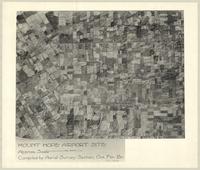
Mount Hope Airport Site
Date
1939-11
Subject
British Commonwealth Air Training Plan, British Commonwealth Air Training Plan--Canada--World War, 1939-1945
Identifier
macrepo:89715, local: MountHope_AirportSite
Title
[Map of Hamilton property of Malcolm Cameron]
Date
1850
Subject
Identifier
macrepo:76565, local: RMC_7739
Title
Sketch of subdivision of lots nos. 3, 4 & 6 corner of Main and Railway Streets in the late James Milles' [Mills] survey
Date
1850
Subject
Identifier
macrepo:76547, local: RMC_7728
Title
[Map of Hamilton property of Malcolm Cameron]
Date
1850
Subject
Identifier
macrepo:76564, local: RMC_7738
Title
Sketch of the survey of 5 lots containing 5 acres each with the exception of no 5 which contains 4 a. [illegible details]: being a part of the northerly half of lot no 12 in the 4th Concession of the Township of Barton
Date
1871
Subject
Identifier
macrepo:76548, local: RMC_7733
Title
Sketch of acre lots in the Township of Barton, adjoining the City of Hamilton
Date
1853-06-03
Subject
Identifier
macrepo:76552, local: RMC_7735
Title
Copy of survey of property on John Street in Robert Jarvis Hamilton Survey
Date
1853-03-10
Subject
Identifier
macrepo:76551, local: RMC_7737
Title
Plan of the road along the centre of the 8th Concession of the Township of East Flamborough[...]
Date
1858-01-30
Subject
Identifier
macrepo:65232
Title
Plan of park-lots laid out in the north part of lot no.5 in the B.F. Con of the Township of Saltfleet
Date
1893-04
Subject
Identifier
macrepo:65257, local: RMC_7531
Title
Plan of the survey of the north end of lot no 19 in fourth conn of Barton into acre lots the property of W.H. Nicolls Esqr.
Date
1854
Subject
Identifier
macrepo:65227
Pages
1
2
3
next ›
last »