Skip to main content
Menu
Home
Digital Archive
McMaster
McMaster Library
Browse
By collection
By language
By location
By subject
About
About
Contact
Contact Us
Digital Preservation Policy
Strategic Framework
Implementation Plan
Copyright Approach for Library Digitization
Home
ont
(x)
wentworth
(x)
america
(x)
longitude
(x)
mcmaster
(x)
1914
(x)
eastern
(x)
province
(x)
Search Digital Archive
Search help
Search results
(1 - 20 of 37)
Pages
1
2
next ›
last »
Title
Map of the provinces of Canada, New Brunswick, Nova Scotia, Newfoundland and Prince Edward Island: with a large section of the United States and exhibiting the boundary of the British Dominions in North America...
Date
1846
Subject
Identifier
macrepo:81413, local: RMC_107416f
Title
Map of the provinces of Canada, New Brunswick, Nova Scotia, Newfoundland and Prince Edward Island: with a large section of the United States and exhibiting the boundary of the British Dominions in North America...
Date
1846
Subject
Identifier
macrepo:81414, local: RMC_107416a
Title
Map of the provinces of Canada, New Brunswick, Nova Scotia, Newfoundland and Prince Edward Island: with a large section of the United States and exhibiting the boundary of the British Dominions in North America...
Date
1846
Subject
Identifier
macrepo:81416, local: RMC_107416c
Title
Map of the provinces of Canada, New Brunswick, Nova Scotia, Newfoundland and Prince Edward Island: with a large section of the United States and exhibiting the boundary of the British Dominions in North America...
Date
1846
Subject
Identifier
macrepo:81417, local: RMC_107416d
Title
Map of the provinces of Canada, New Brunswick, Nova Scotia, Newfoundland and Prince Edward Island: with a large section of the United States and exhibiting the boundary of the British Dominions in North America...
Date
1846
Subject
Identifier
macrepo:81418, local: RMC_107416e
Title
Map of the provinces of Canada, New Brunswick, Nova Scotia, Newfoundland and Prince Edward Island: with a large section of the United States and exhibiting the boundary of the British Dominions in North America...
Date
1846
Subject
Identifier
macrepo:81415, local: RMC_107416b
Title
A map of North America from the latest surveys and maps
Date
1768
Subject
Identifier
macrepo:76554, local: RMC_106457
Title
Canada &c.
Date
1840
Subject
Identifier
macrepo:81374, local: RMC_107789
Title
East Canada, and New Brunswick
Date
1850
Subject
Identifier
macrepo:81426, local: RMC_107667
Title
East Canada, and New Brunswick
Date
1850
Subject
Identifier
macrepo:31845, local: RMC_107026
Title
Canada ou Novvelle France
Date
1683
Subject
Identifier
macrepo:76550, local: RMC_106135
Title
Map of the British possessions in North America
Date
1842
Subject
Identifier
macrepo:26952, local: RMC_107323
Title
A particular map of the American lakes, rivers &c.
Date
1790-06-25
Subject
Identifier
macrepo:22624, local: RMC_6258
Title
Canada and Nova Scotia
Date
1821
Subject
Identifier
macrepo:21598, local: RMC_3838
Title
A new map of Canada, also the north parts of New England and New York; with Nova Scotia and Newfound Land
Date
1760
Subject
Identifier
macrepo:26874, local: RMC_107315
Title
Map showing the different railways by which the eastern townships of Canada East may be reached
Date
1880
Subject
Railroads, Railroads--Ontario--Eastern Townships (Québec)--Northeastern States
Identifier
macrepo:26872, local: RMC_107314
Title
Le Canada, ou Nouvelle France, &c.
Date
1656
Subject
Identifier
macrepo:21586, local: RMC_2582
Title
Carta geografica del Canada nell' America Settentrionale
Date
1750
Subject
Identifier
macrepo:26837, local: RMC_107284
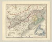
Title
Canada : the provinces of Quebec, Nova Scotia, New Brunswick, Prince Edward Island and Newfoundland
Date
1886
Subject
Identifier
macrepo:27057, local: RMC_107358
Title
Carte réduite, des Costes de l'Acadie, de l'Isle Royale, et de la partie meridionale de l'Isle de Terre-Neuve
Date
1753
Subject
Identifier
macrepo:21757, local: RMC_4157
Pages
1
2
next ›
last »