Skip to main content
Menu
Home
Digital Archive
McMaster
McMaster Library
Browse
By collection
By language
By location
By subject
About
About
Contact
Contact Us
Digital Preservation Policy
Strategic Framework
Implementation Plan
Copyright Approach for Library Digitization
Home
bruce
(x)
map
(x)
springfield
(x)
america
(x)
northern
(x)
river
(x)
Search Digital Archive
Search help
Search results
(1 - 10 of 10)
Title
[19]. Les embouchures de la Somme et de Bresle Riv. ou est St. Valeri, Eu et Dieppe
Date
1745
Subject
Identifier
macrepo:81592, local: RMC_7923_19
Title
[20]. Les environs d'Abbeville, Dourlens, Amiens, Corbie, et du cours de la Somme
Date
1745
Subject
Identifier
macrepo:81593, local: RMC_7923_20
Title
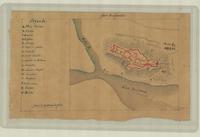
Fort de Fuente
Date
1746
Subject
Identifier
macrepo:81335, local: RMC_F57_suppl_3
Title
[Northern Italy, extending east from the Po River to Plaisance (Piacenza)]
Date
1746
Subject
Identifier
macrepo:81329, local: RMC_F57_suppl_7
Title
Plan de St. Benedict avec les environs...
Date
[1735]
Subject
Identifier
macrepo:81610, local: RMC_102947
Title
Lake Woods, Northern Territory, Australia: AAF aeronautical chart
Date
1943-11
Subject
Aeronautical charts, Aeronautical charts
Identifier
macrepo:77028, local: WW2_AirChart_World_1mil_1221
Title
MacDonnell Ranges, Northern Territory, Australia: AAF aeronautical chart
Date
1943-10
Subject
Aeronautical charts, Aeronautical charts
Identifier
macrepo:77033, local: WW2_AirChart_World_1mil_1232
Title
Georgina River, Queensland, Australia: AAF aeronautical chart
Date
1943-11
Subject
Aeronautical charts, Aeronautical charts
Identifier
macrepo:77034, local: WW2_AirChart_World_1mil_1233
Title
Kargopol and Ustyug: Europe, scale 1:1,000,000
Date
1941
Subject
Identifier
macrepo:70844, local: WW2_Europe_1mil_NP_37_38
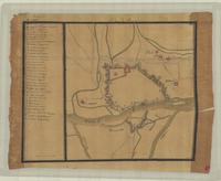
Title
Plan de Payie
Date
1746
Subject
Identifier
macrepo:81336, local: RMC_F57_suppl_4