Search results
Pages
-
-
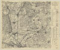
Title
-
Bamberg (North)
-
Date
-
1944
-
Subject
-
World War, 1939-1945, World War, 1939-1945--Germany
-
Identifier
-
macrepo:91040, local: UofA_WW2_GermanyHollandPoland_25k_6031_Ed1
-
![St.Thomas, Ont. : [Sheet 02 of 17]](/islandora/object/macrepo%3A91975/datastream/TN/view)
-
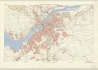
Title
-
St.Thomas, Ont. : [Sheet 02 of 17]
-
Date
-
1929-07
-
Subject
-
Fire risk assessment, Fire risk assessment--St. Thomas (Ont.)
-
Identifier
-
macrepo:91975, local: StThomas_FIP_1929_02
-
-
Title
-
Ottawa-Hull Military Town Plan
-
Date
-
1965
-
Subject
-
Cold War, 1945-1989, Cold War, 1945-1989--Ottawa (Ont.)
-
Identifier
-
macrepo:91990, local: MTP_OttawaHull_1965_ed1_ASE_r
-
![St.Thomas, Ont. : [Sheet 06 of 17]](/islandora/object/macrepo%3A91979/datastream/TN/view)
-
Title
-
St.Thomas, Ont. : [Sheet 06 of 17]
-
Date
-
1929-07
-
Subject
-
Fire risk assessment, Fire risk assessment--St. Thomas (Ont.)
-
Identifier
-
macrepo:91979, local: StThomas_FIP_1929_06
-
![St.Thomas, Ont. : [Sheet 07 of 17]](/islandora/object/macrepo%3A91980/datastream/TN/view)
-
Title
-
St.Thomas, Ont. : [Sheet 07 of 17]
-
Date
-
1929-07
-
Subject
-
Fire risk assessment, Fire risk assessment--St. Thomas (Ont.)
-
Identifier
-
macrepo:91980, local: StThomas_FIP_1929_07
-
![St.Thomas, Ont. : [Sheet 03 of 17]](/islandora/object/macrepo%3A91976/datastream/TN/view)
-
Title
-
St.Thomas, Ont. : [Sheet 03 of 17]
-
Date
-
1929-07
-
Subject
-
Fire risk assessment, Fire risk assessment--St. Thomas (Ont.)
-
Identifier
-
macrepo:91976, local: StThomas_FIP_1929_03
-
![St.Thomas, Ont. : [Sheet 04 of 17]](/islandora/object/macrepo%3A91977/datastream/TN/view)
-
Title
-
St.Thomas, Ont. : [Sheet 04 of 17]
-
Date
-
1929-07
-
Subject
-
Fire risk assessment, Fire risk assessment--St. Thomas (Ont.)
-
Identifier
-
macrepo:91977, local: StThomas_FIP_1929_04
-
![St.Thomas, Ont. : [Sheet 05 of 17]](/islandora/object/macrepo%3A91978/datastream/TN/view)
-
Title
-
St.Thomas, Ont. : [Sheet 05 of 17]
-
Date
-
1929-07
-
Subject
-
Fire risk assessment, Fire risk assessment--St. Thomas (Ont.)
-
Identifier
-
macrepo:91978, local: StThomas_FIP_1929_05
-
![St.Thomas, Ont. : [Sheet 16 of 17]](/islandora/object/macrepo%3A92047/datastream/TN/view)
-
Title
-
St.Thomas, Ont. : [Sheet 16 of 17]
-
Date
-
1929-07
-
Subject
-
Fire risk assessment, Fire risk assessment--St.Thomas (Ont.)
-
Identifier
-
macrepo:92047, local: StThomas_FIP_1929_16
Pages