Search results
Pages
-
-
Title
-
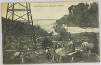
Gas Fields:
-
Date
-
1911-05-05
-
Subject
-
, --
-
Identifier
-
macrepo:100140, local: CPC-00346,
-
-
Title
-
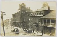
Main St.:
-
Date
-
-
Subject
-
, --
-
Identifier
-
macrepo:101833, local: CPC-00834,
-
-
Title
-
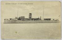
Cruiser Vigilant:
-
Date
-
1912-12-11
-
Subject
-
, --
-
Identifier
-
macrepo:101852, local: CPC-00868,
Pages