Search results
-
-
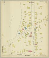
Title
-
Fonthill, Ont.
-
Date
-
1925-06
-
Subject
-
-
Identifier
-
macrepo:75729, local: Fonthill_FIP_1925_2
-

-
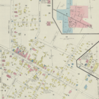
Title
-
Niagara
-
Date
-
1937
-
Subject
-
-
Identifier
-
macrepo:77626, local: WWII_Canada_Niagara
-
-
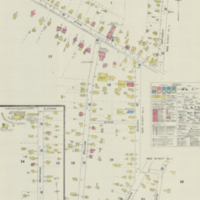
Title
-
Beamsville, Ont.
-
Date
-
1921-10
-
Subject
-
-
Identifier
-
macrepo:48083, local: Beamsville_FIP_1921_01
-
-
Title
-
Beamsville, Ont.
-
Date
-
1921-10
-
Subject
-
-
Identifier
-
macrepo:48082, local: Beamsville_FIP_1921_02
-
-
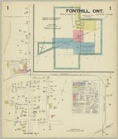
Title
-
Fonthill, Ont.
-
Date
-
1925-06
-
Subject
-
-
Identifier
-
macrepo:75727, local: Fonthill_FIP_1925_1
-

-
Title
-
Fonthill, Ont.
-
Date
-
1925-06
-
Subject
-
-
Identifier
-
macrepo:75730, local: Fonthill_FIP_1925_3