Skip to main content
Menu
Home
Digital Archive
McMaster
McMaster Library
Browse
By collection
By language
By location
By subject
About
About
Contact
Contact Us
Digital Preservation Policy
Strategic Framework
Implementation Plan
Copyright Approach for Library Digitization
Home
*
(x)
brantford
(x)
region
(x)
caledonia
(x)
america
(x)
river
(x)
Search Digital Archive
Search help
Search results
(1 - 20 of 432)
Pages
1
2
3
4
5
…
next ›
last »
Title
A map of North America from the latest surveys and maps
Date
1768
Subject
Identifier
macrepo:76554, local: RMC_106457
Title
Conibas regio cvm vicinis gentibvs
Date
1597
Identifier
macrepo:81289, local: RMC_107754
Title
[Greater Hamilton Area, from Caledonia to Vineland, 1934-07-01] : [Flightline A4701-Photo 24]:
Date
Subject
Identifier
macrepo:72308, local: AirPhotos_Hamilton_1934_A4701-24
Title
[Greater Hamilton Area, from Caledonia to Vineland, 1934-07-01] : [Flightline A4702-Photo 20]:
Date
Subject
Identifier
macrepo:71874, local: AirPhotos_Hamilton_1934_A4702-20
Title
[Regional Municipality of Hamilton-Wentworth and surrounding area, 1954] : [Flightline 4309-Photo 8]:
Date
1954
Subject
Identifier
macrepo:73050, local: AirPhotos_Hamilton_1954-1955_4309-8
Title
[Regional Municipality of Hamilton-Wentworth and surrounding area, 1954] : [Flightline 4313-Photo 121]:
Date
1954
Subject
Identifier
macrepo:73052, local: AirPhotos_Hamilton_1954-1955_4313-121
Title
[Regional Municipality of Hamilton-Wentworth and surrounding area, 1954] : [Flightline 4323-Photo 177]:
Date
1954
Subject
Identifier
macrepo:73045, local: AirPhotos_Hamilton_1954-1955_4323-177
Title
La Pensilvania, la Nuova York, il Jersey Settentriole.: con la parte occidentale del Connecticut, Massachusset-s-Bay e l'Irochesia
Date
1779
Subject
Identifier
macrepo:76560, local: RMC_107021
Title
A particular map of the American lakes, rivers &c.
Date
1790-06-25
Subject
Identifier
macrepo:22624, local: RMC_6258
Title
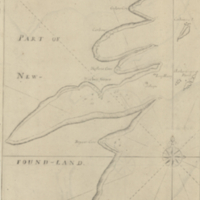
A chart of the south-east coast of Newfoundland
Date
1780
Subject
Coasts, Coasts--Newfoundland and Labrador--Placentia Bay Region (N.L.)
Identifier
macrepo:21590, local: RMC_3823
Title
A new map of Canada, also the north parts of New England and New York; with Nova Scotia and Newfound Land
Date
1760
Subject
Identifier
macrepo:26874, local: RMC_107315
Title
Carte de la Baye de Hudson pour servir à l'Histoire generale des voyages
Date
1757
Subject
Identifier
macrepo:26879, local: RMC_107319
Title
Comparative map of the Ottawa and St Lawrence waterways
Date
1895
Subject
Identifier
macrepo:26994, local: RMC_107340
Title
North America : sheet III. Upper Canada with parts of New-York, Pennsylvania and Michigan
Date
1832-09-01
Subject
Identifier
macrepo:27002, local: RMC_107344
Title
North America : sheet IV Lake Superior, reduced from the Admiralty Survey
Date
1832-11-01
Subject
Identifier
macrepo:26992, local: RMC_107339
Title
Map of country south of Harbin, to illustrate the campaign in Manchuria
Date
1905-05
Subject
Russo-Japanese War, 1904-1905, Russo-Japanese War, 1904-1905--Harbin Region (China)--Manchuria (China)
Identifier
macrepo:70443, local: Misc_SouthofHarbin_420k
Title
Carte de la Baye de Hudson, pour servir à l'Histoire générale des voyages
Date
1757
Subject
Identifier
macrepo:32220, local: RMC_107031
Title
Partie occidentale du Canada, contenant les cinq Grands Lacs, avec les pays circonvoisins
Date
1780
Subject
Identifier
macrepo:32226, local: RMC_107035
Title
Harbor Grace
Date
1755
Subject
Identifier
macrepo:23908, local: RMC_8904
Title
Canada West formerly Upper Canada
Date
1850
Subject
Identifier
macrepo:26985, local: RMC_107335
Pages
1
2
3
4
5
…
next ›
last »