Search results
Pages
-
-
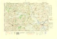
Title
-
La Haye Du Puits
-
Date
-
1943
-
Subject
-
World War, 1939-1945, World War, 1939-1945--France
-
Identifier
-
macrepo:89198, local: WW2_France_50k_GSGS4250_06E05
-
-
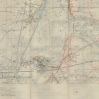
Title
-
La Fere 66c.SW.4: France
-
Date
-
1918-01
-
Subject
-
Maps, World War, 1914-1918, Maps, World War, 1914-1918--France
-
Identifier
-
macrepo:4286, local: 106WW1MAP
-
-
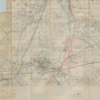
Title
-
La Fere 66c.SW.4: France
-
Date
-
1918-01
-
Subject
-
Maps, World War, 1914-1918, Maps, World War, 1914-1918--France
-
Identifier
-
macrepo:4290, local: 213WW1MAP
-

-
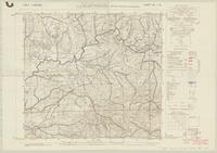
Title
-
La Bassee 36c.NW.1: France
-
Date
-
1917-12
-
Subject
-
Maps, World War, 1914-1918, Maps, World War, 1914-1918--France
-
Identifier
-
macrepo:4254, local: 133WW1MAP
-

-
Title
-
La Motte (part of) 36a.NE: France
-
Date
-
1918-04
-
Subject
-
Maps, World War, 1914-1918--Trench warfare--Maps, Maps, World War, 1914-1918--Trench warfare--Maps--France
-
Identifier
-
macrepo:4329, local: 235WW1MAP
-
-
Title
-
La Farnesiana
-
Date
-
1943
-
Subject
-
World War, 1939-1945, World War, 1939-1945--Italy
-
Identifier
-
macrepo:83355, local: UofA_WW2_Italy_25k_142_I_SE
-
-
Title
-
La Vachey
-
Date
-
1942
-
Subject
-
World War, 1939-1945, World War, 1939-1945--Italy
-
Identifier
-
macrepo:86270, local: UofA_WW2_Italy_25k_028_IV_SW_ger
-
![[Loos] 36c.NW](/islandora/object/macrepo%3A4081/datastream/TN/view)
-
Title
-
[Loos] 36c.NW: France
-
Date
-
1917-05
-
Subject
-
Maps, World War, 1914-1918, Maps, World War, 1914-1918--France
-
Identifier
-
macrepo:4081, local: 051WW1MAP
-
![36c.G3 [Dundee Walk, Berwick, Old Boots, Munster, and Parade Trenches] February 2, 1917](/islandora/object/macrepo%3A5241/datastream/TN/view)
-
Title
-
36c.G3 [Dundee Walk, Berwick, Old Boots, Munster, and Parade Trenches] February 2, 1917: France
-
Date
-
1917-02-14
-
Subject
-
Aerial reconnaissance, World War, 1914-1918, Aerial reconnaissance, World War, 1914-1918--France--World War, 1914-1918
-
Identifier
-
macrepo:5241, local: WW1AIR371
-
![[Loos] 44a.NW 36c.NW](/islandora/object/macrepo%3A4167/datastream/TN/view)
-
Title
-
[Loos] 44a.NW 36c.NW: France
-
Date
-
1918-06
-
Subject
-
Maps, World War, 1914-1918--Trench warfare--Maps, Maps, World War, 1914-1918--Trench warfare--Maps--France
-
Identifier
-
macrepo:4167, local: 067WW1MAP
-
-
Title
-
La Maddalena
-
Date
-
1943
-
Subject
-
World War, 1939-1945, World War, 1939-1945--Italy
-
Identifier
-
macrepo:83693, local: UofA_WW2_Italy_25k_168_I_SE_Part_NE
-

-
Title
-
La Cretagna
-
Date
-
1956
-
Subject
-
World War, 1939-1945, World War, 1939-1945--Italy
-
Identifier
-
macrepo:83883, local: UofA_WW2_Italy_25k_200_II_NE
-
-
Title
-
La Maddalena
-
Date
-
1943
-
Subject
-
World War, 1939-1945, World War, 1939-1945--Italy
-
Identifier
-
macrepo:84709, local: UofA_WW2_Italy_50k_168_I
Pages