Search results
-
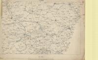
![[Lille Region, north]](/islandora/object/macrepo%3A70143/datastream/TN/view)
-
Title
-
[Lille Region, north]
-
Date
-
1916-05-01
-
Subject
-
World War, 1914-1918, World War, 1914-1918--France--Belgium
-
Identifier
-
macrepo:70143
-
![[Lille Region, north]](/islandora/object/macrepo%3A70145/datastream/TN/view)
-
Title
-
[Lille Region, north]
-
Date
-
1917-10-21
-
Subject
-
World War, 1914-1918, World War, 1914-1918--France--Belgium
-
Identifier
-
macrepo:70145
-
![[Lille Region, north]](/islandora/object/macrepo%3A70144/datastream/TN/view)
-
Title
-
[Lille Region, north]
-
Date
-
1917-05-07
-
Subject
-
World War, 1914-1918, World War, 1914-1918--France--Belgium
-
Identifier
-
macrepo:70144
-
-
Title
-
Cassel
-
Date
-
1914
-
Subject
-
World War, 1914-1918, World War, 1914-1918--France
-
Identifier
-
macrepo:73914, local: PC0754