Search results
Pages
-

-
Title
-
Twelve Mile Creek conservation report, 1960
-
Date
-
1960
-
Subject
-
Natural resources--Conservation, Natural resources--Conservation--Canada--Ontario, Reclamation of land, Reclamation of land, Forest conservation, Forest conservation--Ontario--Twelve Mile Creek, HC117 O62 T9
-
Author(s)
-
Ontario Dept. of Commerce and Development.et al
-
Identifier
-
macrepo:6356
-
Modat DT date
-
1960-01-01T00:00:00Z
-

-
Title
-
Twelve Mile Creek conservation report. Recreation
-
Date
-
1959
-
Subject
-
Natural resources, Natural resources--Ontario--Twelve Mile Creek, Outdoor recreation, Outdoor recreation--Ontario--Twelve Mile Creek, Forest conservation, Forest conservation--Ontario--Twelve Mile Creek, S918.C2 T88 1959, HC117.O62 T9 1959
-
Identifier
-
macrepo:6399
-
Modat DT date
-
1959-01-01T00:00:00Z
-
-
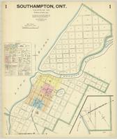
Title
-
Southampton, Ont.
-
Date
-
1928-05
-
Subject
-
-
Identifier
-
macrepo:88113, local: Southampton_FIP_1928_01
-
-
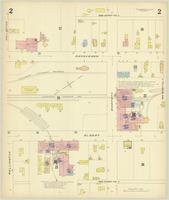
Title
-
Southampton, Ont.
-
Date
-
1928-05
-
Subject
-
-
Identifier
-
macrepo:88130, local: Southampton_FIP_1928_03
-
-
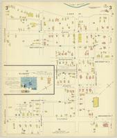
Title
-
Southampton, Ont.
-
Date
-
1928-05
-
Subject
-
-
Identifier
-
macrepo:88126, local: Southampton_FIP_1928_02
-
-
Title
-
Southampton, Ont.
-
Date
-
1928-05
-
Subject
-
-
Identifier
-
macrepo:88140, local: Southampton_FIP_1928_05
-
-
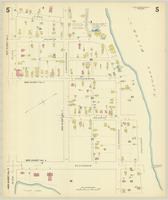
Title
-
Southampton, Ont.
-
Date
-
1928-05
-
Subject
-
-
Identifier
-
macrepo:88137, local: Southampton_FIP_1928_04
-

-
Title
-
Brighton, Ont.
-
Date
-
1926-07
-
Subject
-
-
Identifier
-
macrepo:81270, local: Brighton_FIP_1926_01
-
-
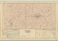
Title
-
W. Zorra Township
-
Date
-
1876
-
Subject
-
-
Identifier
-
macrepo:81290, local: RMC_107785
Pages