Skip to main content
Menu
Home
Digital Archive
McMaster
McMaster Library
Browse
By collection
By language
By location
By subject
About
About
Contact
Contact Us
Digital Preservation Policy
Strategic Framework
Implementation Plan
Copyright Approach for Library Digitization
Home
*
(x)
ont
(x)
north
(x)
longitude
(x)
world
(x)
river
(x)
and
(x)
Search Digital Archive
Search help
Search results
(1 - 20 of 32)
Pages
1
2
next ›
last »
Title
Mariana Islands, North Pacific Ocean: AAF aeronautical chart
Date
1945-06
Subject
Aeronautical charts, Aeronautical charts
Identifier
macrepo:76768, local: WW2_AirChart_World_1mil_0624
Title
[Topographical survey of the Rocky Mountains] : Banff sheet
Date
1888
Subject
Identifier
macrepo:81124, local: Rocky_Mountains_Survey_1888_Banff
Title
Index to sheets of the Topographical Survey of the Rocky Mountains
Date
1888
Subject
Identifier
macrepo:81123, local: Rocky_Mountains_Survey_Index
Title
[Topographical survey of the Rocky Mountains] : Simpson's Pass sheet
Date
1891
Subject
Identifier
macrepo:81214, local: Rocky_Mountains_Survey_1891_SimpsonsPass
Title
[Topographical survey of the Rocky Mountains] : Cascade Mountain sheet
Date
1890
Subject
Identifier
macrepo:81127, local: Rocky_Mountains_Survey_1890_CascadeMountain
Title
[Topographical survey of the Rocky Mountains] : Saddle Mountain sheet
Date
1889
Subject
Identifier
macrepo:81176, local: Rocky_Mountains_Survey_1889_SaddleMountain
Title
Island of Hawaii, North Pacific Ocean: AAF aeronautical chart
Date
1944-07
Subject
Aeronautical charts, Aeronautical charts
Identifier
macrepo:76804, local: WW2_AirChart_World_1mil_0634
Title
Davao Gulf, Mindanao, Philippines: AAF aeronautical chart
Date
1945-01
Subject
Aeronautical charts, Aeronautical charts
Identifier
macrepo:76948, local: WW2_AirChart_World_1mil_0855
Title
Manila Bay, Philippine Islands: AAF aeronautical chart
Date
1945-06
Subject
Aeronautical charts, Aeronautical charts
Identifier
macrepo:76916, local: WW2_AirChart_World_1mil_0735
Title
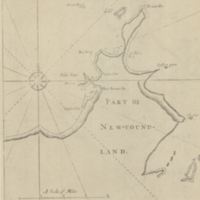
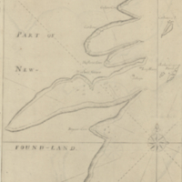
A general chart of the Island of Newfoundland with the rocks & soundings
Date
1775-05-10
Subject
Identifier
macrepo:21591, local: RMC_3824
Title
Carte réduite de la partie septentrionale de l'isle de Terre Neuve
Date
1767
Subject
Identifier
macrepo:21589, local: RMC_3822
Title
Carte des isles de Miquelon et de St. Pierre et la coste de Terre-neuve voisine
Date
1764
Subject
Identifier
macrepo:21593, local: RMC_3828
Title
A chart of the south-east coast of Newfoundland
Date
1780
Subject
Coasts, Coasts--Newfoundland and Labrador--Placentia Bay Region (N.L.)
Identifier
macrepo:21590, local: RMC_3823
Title
Geological map of Newfoundland from the Geological map of Canada
Date
1875
Subject
Identifier
macrepo:27006, local: RMC_107345
Title
Carte de l'Isle de Terre-Neuve
Date
1744
Subject
Identifier
macrepo:26958, local: RMC_107326
Title
Port Bonavista
Date
1755
Subject
Identifier
macrepo:23902, local: RMC_8905
Title
Harbor Grace
Date
1755
Subject
Identifier
macrepo:23908, local: RMC_8904
Title
Carte des bayes, rades, et port de Plaisance dans l'isle de Terre-Neuve
Date
1764
Subject
Identifier
macrepo:21588, local: RMC_3821
Title
Truk Islands : special strategic map
Date
1943-02
Subject
Identifier
macrepo:70817, local: ww2_strategic_map_Truk_1mil
Title
Guam, North Pacific Ocean: AAF aeronautical chart
Date
1944-05
Subject
Aeronautical charts, Aeronautical charts
Identifier
macrepo:76895, local: WW2_AirChart_World_1mil_0731
Pages
1
2
next ›
last »