Skip to main content
Menu
Home
Digital Archive
McMaster
McMaster Library
Browse
By collection
By language
By location
By subject
About
About
Contact
Contact Us
Digital Preservation Policy
Strategic Framework
Implementation Plan
Copyright Approach for Library Digitization
Home
*
(x)
wentworth
(x)
fire
(x)
longitude
(x)
poland
(x)
america
(x)
province
(x)
region
(x)
Search Digital Archive
Search help
Search results
(1 - 20 of 30)
Pages
1
2
next ›
last »
Title
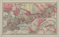
The Canadian Dominion survey, with distances, a new railway, post-office, township and precinct map of Ontario and Quebec: compiled from the latest government surveys and other official sources
Date
1899
Subject
Identifier
macrepo:81393, local: RMC_107406
Title
Tunison's Canada
Date
1885
Subject
Identifier
macrepo:81256, local: RMC_107363r
Title
This topographical map of the districts of Quebec, Three Rivers, St. Francis and Gaspé, Lower Canada: exhibiting the new civil division of the districts into counties pursuant to a recent act of the Provincial Legislature
Date
1831-05-02
Subject
Identifier
macrepo:81914, local: RMC_102982_n
Title
This topographical map of the districts of Quebec, Three Rivers, St. Francis and Gaspé, Lower Canada: exhibiting the new civil division of the districts into counties pursuant to a recent act of the Provincial Legislature
Date
1831-05-02
Subject
Identifier
macrepo:81917, local: RMC_102982_nw
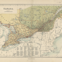
Title
Canada
Date
1860
Subject
Identifier
macrepo:26876, local: RMC_107316
Title
Map of Quebec in counties
Date
1867
Subject
Identifier
macrepo:26968, local: RMC_107328
Title
Map of the eastern townships of Lower Canada
Date
1834
Subject
Identifier
macrepo:26970, local: RMC_107329
Title
Map of Canada East in counties
Date
1862
Subject
Identifier
macrepo:26960, local: RMC_107327
Title
Geographical, statistical, and historical map of Upper and Lower Canada, and the other British possessions in North America
Date
1827
Subject
Identifier
macrepo:21579, local: RMC_2571
Title
Dominion of Canada (east central sheet)
Date
1880
Subject
Identifier
macrepo:27014, local: RMC_107352
Title
Dominion of Canada (western sheet)
Date
1872
Subject
Identifier
macrepo:27012, local: RMC_107350
Title
This topographical map of the districts of Quebec, Three Rivers, St. Francis and Gaspé, Lower Canada: exhibiting the new civil division of the districts into counties pursuant to a recent act of the Provincial Legislature
Date
1831-05-02
Subject
Identifier
macrepo:81919, local: RMC_102982_ne
Title
This topographical map of the districts of Quebec, Three Rivers, St. Francis and Gaspé, Lower Canada: exhibiting the new civil division of the districts into counties pursuant to a recent act of the Provincial Legislature
Date
1831-05-02
Subject
Identifier
macrepo:81920, local: RMC_102982_se
Title
This topographical map of the districts of Quebec, Three Rivers, St. Francis and Gaspé, Lower Canada: exhibiting the new civil division of the districts into counties pursuant to a recent act of the Provincial Legislature
Date
1831-05-02
Subject
Identifier
macrepo:81918, local: RMC_102982_sw
Title
This topographical map of the districts of Quebec, Three Rivers, St. Francis and Gaspé, Lower Canada: exhibiting the new civil division of the districts into counties pursuant to a recent act of the Provincial Legislature
Date
1831-05-02
Subject
Identifier
macrepo:81913, local: RMC_102982_s
Title
Canada : the Province of Ontario, and part of Quebec
Date
1886
Subject
Identifier
macrepo:27059, local: RMC_107359
Title
A chart of the Magdalen Islands in the Gulf of St. Laurence surveyed in 1765
Date
1794
Subject
Identifier
macrepo:21756, local: RMC_4156
Title
Canada. West sheet
Date
1859
Subject
Identifier
macrepo:30949, local: RMC_107371
Title
Geographical, statistical, and historical map of Upper and Lower Canada, and the other British possessions in North America
Date
1815
Subject
Identifier
macrepo:30947, local: RMC_107369
Title
Province of Canada (western sheet)
Date
1861
Subject
Identifier
macrepo:30950, local: RMC_107372
Pages
1
2
next ›
last »