Search results
-
-
Title
-
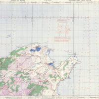
Tunis: 1:500,000 Africa (Air)
-
Date
-
1941
-
Subject
-
Aeronautical charts, Aeronautical charts--Africa, North
-
Identifier
-
macrepo:48699, local: ww2_Africa_500k_Air_Tunis
-
-
Title
-
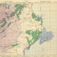
Sfax: 1:500,000 Africa (Air)
-
Date
-
1942
-
Subject
-
Aeronautical charts, Aeronautical charts--Africa, North
-
Identifier
-
macrepo:48697, local: ww2_Africa_500k_Air_Sfax
-

-
Title
-
A map of the discoveries made by Capts. Cook & Clerke, in the years 1778 & 1779: between the eastern coast of Asia and the western coast of North America, when they attempted to navigate the North Sea....
-
Date
-
1785-01-01
-
Subject
-
Cook, James, 1728-1779--Clerke, Charles, 1741-1779, Cook, James, 1728-1779--Clerke, Charles, 1741-1779--North Pacific Ocean--Pacific Coast (North America)--Pacific Coast (Asia)
-
Identifier
-
macrepo:21771, local: RMC_4172