Search results
-
![20.X2 [Roulers] September 21, 1917](/islandora/object/macrepo%3A4675/datastream/TN/view)
-
Title
-
20.X2 [Roulers] September 21, 1917: Belgium
-
Date
-
1917-09-21
-
Subject
-
Aerial reconnaissance, World War, 1914-1918, Aerial reconnaissance, World War, 1914-1918--Belgium--World War, 1914-1918
-
Identifier
-
macrepo:4675, local: WW1AIR00148
-
![[Roulers] 20.SE](/islandora/object/macrepo%3A3987/datastream/TN/view)
-
Title
-
[Roulers] 20.SE: Belgium
-
Date
-
1917-10
-
Subject
-
Maps, World War, 1914-1918, Maps, World War, 1914-1918--Belgium
-
Identifier
-
macrepo:3987, local: 296WW1MAP
-
-
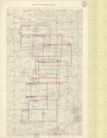
Title
-
Index to Special Maps
-
Date
-
1918-03-02
-
Subject
-
World War, 1914-1918, World War, 1914-1918--Belgium--France
-
Identifier
-
macrepo:73992, local: PC0790