Skip to main content
Menu
Home
Digital Archive
McMaster
McMaster Library
Browse
By collection
By language
By location
By subject
About
About
Contact
Contact Us
Digital Preservation Policy
Strategic Framework
Implementation Plan
Copyright Approach for Library Digitization
Home
*
(x)
aeronaut
(x)
belgium
(x)
1918
(x)
ypres
(x)
world
(x)
france
(x)
omer
(x)
Search Digital Archive
Search help
Search results
(1 - 19 of 19)
Title
Road and bridge map, showing roads normally suitable for motor traffic, road bridges and light railways: Tournai and part of Hazebrouck
Date
1916
Subject
World War, 1914-1918, World War, 1914-1918--Belgium--France
Identifier
macrepo:74450, local: PC0833
Title
Fifth Army area (showing traffic circuits dated 23-6-17)
Date
1917-06-23
Subject
World War, 1914-1918, World War, 1914-1918--Belgium--France
Identifier
macrepo:74446, local: PC0826
Title
Fifth Army area (showing traffic circuits dated 24-7-17)
Date
1917-07-24
Subject
World War, 1914-1918, World War, 1914-1918--Belgium--France
Identifier
macrepo:74460, local: PC0827
Title
Calais to the Somme : billeting area map, issued with O.A., 414., dated 23-10-18
Date
1918-10-23
Subject
World War, 1914-1918, World War, 1914-1918--Belgium--France
Identifier
macrepo:74468, local: PC0842ww1map
Title
N. E. France & part of Belgium : billeting area map, issued with O.A. 414, dated 30.1.18
Date
1917-06
Subject
World War, 1914-1918, World War, 1914-1918--Belgium--France
Identifier
macrepo:74466, local: PC0840
Title
[Ypres Salient]: [Belgium & France]
Date
1917-01-28
Subject
World War, 1914-1918, World War, 1914-1918--Belgium--France
Identifier
macrepo:71408, local: PC0858
Title
[Second] Army area map, no. 7 : index to panoramas
Date
1918-07-31
Subject
World War, 1914-1918, World War, 1914-1918--Belgium--France
Identifier
macrepo:73999, local: PC0797ww1map
Title
Army traffic map : Ypres - Armentieres Area
Date
1917-10-27
Subject
World War, 1914-1918, World War, 1914-1918--Belgium--France
Identifier
macrepo:73991, local: PC0789ww1map
Title
[Second] Army area map, no. 7 : enemy order of battle, 6 pm. 10th May 1918
Date
1918-05-10
Subject
World War, 1914-1918, World War, 1914-1918--Belgium--France
Identifier
macrepo:73994, local: PC0792ww1map
Title
[Second] Army area map, no. 7 : index to panoramas
Date
1918-08-31
Subject
World War, 1914-1918, World War, 1914-1918--Belgium--France
Identifier
macrepo:74000, local: PC0798ww1map
Title
Second Army area (east) : sketch map, showing supposed location of enemy's forces on 15th March, 1917
Date
1917-03-15
Subject
World War, 1914-1918, World War, 1914-1918--Belgium, France
Identifier
macrepo:73987, local: PC0785
Title
Second Army area (east) : sketch map, showing supposed location of enemy's forces on 15th February 1917
Date
1917-02-15
Subject
World War, 1914-1918, World War, 1914-1918--Belgium, France
Identifier
macrepo:73986, local: PC0784
Title
[Second Army area : Ypres, Lille Region, 1915]
Date
1915
Subject
World War, 1914-1918, World War, 1914-1918--Belgium--France
Identifier
macrepo:73985, local: PC0783ww1map
Title
Second Army area : showing traffic circuits dated 20-4-17
Date
1917-04-20
Subject
World War, 1914-1918, World War, 1914-1918--Belgium--France
Identifier
macrepo:73989, local: PC0787
Title
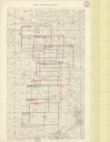
Index to Special Maps
Date
1918-03-02
Subject
World War, 1914-1918, World War, 1914-1918--Belgium--France
Identifier
macrepo:73992, local: PC0790
Title
[Second] Army area map, no. 8 : hostile aerodromes and hospitals, from air photographs, April 1st - May 15th, 1918
Date
1918-06-06
Subject
World War, 1914-1918, World War, 1914-1918--Belgium--France
Identifier
macrepo:74003, local: PC0800ww1map
Title
[Second] Army area map, no. 9 : hostile aerodromes opposite Second Army front, August 23rd, 1918 (from air photographs)
Date
1918-08-23
Subject
World War, 1914-1918, World War, 1914-1918--Belgium--France
Identifier
macrepo:74106, local: PC0803ww1map
Title
[Second] Army area map, no. 9 : enemy hospital signs opposite Second Army front (from air photographs), June 6th, 1918
Date
1918-06-06
Subject
World War, 1914-1918, World War, 1914-1918--Belgium--France
Identifier
macrepo:74105, local: PC0802ww1map
Title
[Second] Army area map, no. 9 : hostile aerodromes opposite Second Army front, June 6th 1918 (from air photographs)
Date
1918-06-06
Subject
World War, 1914-1918, World War, 1914-1918--Belgium--France
Identifier
macrepo:74060, local: PC0801ww1map