Skip to main content
Menu
Home
Digital Archive
McMaster
McMaster Library
Browse
By collection
By language
By location
By subject
About
About
Contact
Contact Us
Digital Preservation Policy
Strategic Framework
Implementation Plan
Copyright Approach for Library Digitization
Home
*
(x)
mississauga
(x)
canada
(x)
belgium
(x)
belgium
(x)
france
(x)
Search Digital Archive
Search help
Search results
(1 - 20 of 29)
Pages
1
2
next ›
last »
Title
Army area map no. 10 : army training areas map, October, 1918
Date
1918-10
Subject
World War, 1914-1918, World War, 1914-1918--France
Identifier
macrepo:74109, local: PC0806
Title
London - Munchen: Radar Plotting Chart
Date
1944-12
Subject
Identifier
macrepo:82164, local: WW2_Radar_1mil_London-Munchen
Title
London - Munchen: Ruhr fixing chart
Date
1945-01
Subject
Identifier
macrepo:82167, local: WW2_Radar_1mil_London-Munchen_RuhrChart
Title
English Channel, copy 2: Plotting series
Date
1944-07
Subject
Identifier
macrepo:82152, local: WW2_Plotting_1mil_EnglishChannel_2
Title
London - Munchen: Reims fixing chart
Date
1944-12
Subject
Identifier
macrepo:82169, local: WW2_Radar_1mil_London-Munchen_ReimsChart
Title
Strait of Dover, Cologne Chain: Lattice Topographical Map
Date
1944-12
Subject
Identifier
macrepo:82190, local: WW2_Lattice_500k_StraitOfDover_CologneChain
Title
Army area map no. 10 : Watten Bridge Head - Merckeghem Switch - St. Omer - Sercus Line, signal communications
Date
1918-08-14
Subject
World War, 1914-1918, World War, 1914-1918--France
Identifier
macrepo:74107, local: PC0804
Title
War map : specially indicating scenes where Canadian troops distinguished themselves
Date
1918
Subject
World War, 1914-1918, World War, 1914-1918--France
Identifier
macrepo:76369, local: Montreal_Star_War_Map_r
Title
Johnston's chart of the Baltic Sea, German Ocean & English Channel: with the adjoining countries showing the principal lines of railway communication to the coasts of Northern Europe
Date
1854
Subject
Identifier
macrepo:76359, local: RMC_5452
Title
[23]. Carte particuliere des environs de Philippeville, Charlemont, Marienbourg, Rocroy, Charleville, Mezieres, Sedan
Date
1745
Subject
Identifier
macrepo:81596, local: RMC_7923_23
Title
[12]. Carte particuliere des environs de Maestricht, partie de Liege Faucquemont, et pays d'Outre-Meuse
Date
1745
Subject
Identifier
macrepo:81585, local: RMC_7923_12
Title
[16]. Carte particuliere des environs de Mons, d'Ath, de Charleroy, de Maubeuge, du Quesoy, de Condé, &c.
Date
1745
Subject
Identifier
macrepo:81589, local: RMC_7923_16
Title
A new map of Flanders & the other provinces of the Spanish Netherlands with part of England, Holland, France &c.: exhibiting a full view of the seat of war wth. the towns & rivers mention'd in the actions & encampments
Date
1700
Subject
Identifier
macrepo:82205, local: RMC_4202
Title
English Channel: Plotting series
Date
1944-07
Subject
Identifier
macrepo:81934, local: WW2_Plotting_1mil_EnglishChannel
Title
Belfast - Rome: Small scale plotting series
Date
1942-07
Subject
Identifier
macrepo:81940, local: WW2_Plotting_2mil_Belfast-Rome
Title
Western Germany: Plotting series
Date
1944-06
Subject
Identifier
macrepo:81937, local: WW2_Plotting_1mil_WestGermany
Title
Strait of Dover, Channel Chain: Lattice Topographical Map
Date
1944-06
Subject
World War, 1939-1945, World War, 1939-1945--World War, 1939-1945
Identifier
macrepo:87635, local: WW2_Lattice_500k_StraitOfDover_ChannelChain
Title
Menin ; Plan de la Ville de Menin
Subject
Identifier
macrepo:78247, RMC_9172
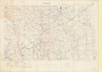
Title
Zonnebeke: Belgium
Date
1917-09-08
Subject
World War, 1914-1918, World War, 1914-1918--France
Identifier
macrepo:66734, local: PC0026
Title
[Pas-de-Calais, Mont St. Eloi Region, west of Arras : artillery map]: [Belgium & France]
Date
1916
Subject
World War, 1914-1918
Identifier
macrepo:70482, local: PC0352
Pages
1
2
next ›
last »