Search results
Pages
-
-
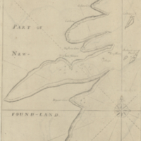
Title
-
Harbor Grace
-
Date
-
1755
-
Subject
-
-
Identifier
-
macrepo:23908, local: RMC_8904
-

-
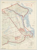
Title
-
Connaught Range
-
Date
-
1935
-
Subject
-
-
Identifier
-
macrepo:74495, local: WW2_TrainingBase_ConnaughtRange
-
-
Title
-
Petawawa
-
Date
-
1939
-
Subject
-
-
Identifier
-
macrepo:74496, local: WW2_TrainingBase_Petawawa_1939
Pages