Skip to main content
Menu
Home
Digital Archive
McMaster
McMaster Library
Browse
By collection
By language
By location
By subject
About
About
Contact
Contact Us
Digital Preservation Policy
Strategic Framework
Implementation Plan
Copyright Approach for Library Digitization
Home
*
(x)
north
(x)
franc
(x)
world
(x)
1945
(x)
wales
(x)
netherlands
(x)
and
(x)
germany
(x)
Search Digital Archive
Search help
Search results
(1 - 20 of 647)
Pages
1
2
3
4
5
…
next ›
last »
Title
Frankfurt, Louvain Chain: Lattice Topographical Map
Date
1944-09
Subject
Identifier
macrepo:82170, local: WW2_Lattice_500k_Frankfurt_LouvainChain
Title
Frankfurt, Reims Chain: Lattice Topographical Map
Date
1944-10
Subject
Identifier
macrepo:82175, local: WW2_Lattice_500k_Frankfurt_ReimsChain
Title
Berlin, Cologne Chain: Lattice Topographical Map
Date
1943
Subject
Identifier
macrepo:82173, local: WW2_Lattice_500k_Berlin_CologneChain
Title
Villingen-Sigmaringen-Tuttlingen-Überlingen: Germany 1:100,000 Series
Date
1943
Subject
Identifier
macrepo:75461, local: ww2_Germany_100k_152a
Title
Carte de la position du camp de Merlheim du.11.Septembre.1743 Avec les Cours de la Riviere de la queiche. [sketch map]: depuis L'andau jusques a son Embouchure dans le Rhin les Redouttes Retranchemens et digues que l'on y a faites
Date
[1743-?]
Subject
Identifier
macrepo:81088, local: RMC_9450
Title
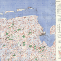
Wilhelmshaven
Date
1944
Subject
Identifier
macrepo:20475, ww2_CentralEurope_100k_L2_ED1
Title
[Germany: western and central regions]
Date
[1700-1800?]
Subject
Identifier
macrepo:81098, local: RMC_9275
Title
Bohmer Forest, Germany: AAF aeronautical chart
Date
1944-02
Subject
Aeronautical charts, Aeronautical charts
Identifier
macrepo:76620, local: WW2_AirChart_World_1mil_0231
Title
Exactissima statuum totius ducatus Bavariæ tabula secunfum omnes status & præfecuras... [6 maps on 1 sheet]: Cum insertis et finitmis regionibus in IX Mappis Geograp: Recens elucubrata et singulatim divisa
Date
1760
Subject
Identifier
macrepo:78199, local: RMC_9456
Title
Coburg
Date
1944
Subject
Identifier
macrepo:21607, ww2_CentralEurope_100k_S5_ED1
Title
Berlin, Ruhr Chain: Lattice Topographical Map
Date
1943
Subject
Identifier
macrepo:82177, local: WW2_Lattice_500k_Berlin_RuhrChain
Title
Kriegs Theater der Teutschen und Franzoesischen grænz landen zwischen dem Rhein und der Mosel, im iahr 1794. [Sheet 4 & 6]
Date
1794
Subject
Identifier
macrepo:79181, local: RMC_9493
Title
Bremen, Louvain Chain: Lattice Topographical Map
Date
1944-09
Subject
Identifier
macrepo:82189, local: WW2_Lattice_500k_Bremen_LouvainChain
Title
Berlin, Reims Chain: Lattice Topographical Map
Date
1944-10
Subject
Identifier
macrepo:82174, local: WW2_Lattice_500k_Berlin_ReimsChain
Title
Das Konigreich Baiern nebst den angrenzenden Landern...[The Kingdom of Bavaria, together with the adjoining lands...]
Date
1813
Subject
Identifier
macrepo:78198, local: RMC_9455
Title
Gulf of Danzig, Poland-Germany: AAF aeronautical chart
Date
1943-09
Subject
Aeronautical charts, Aeronautical charts
Identifier
macrepo:76596, local: WW2_AirChart_World_1mil_0169
Title
War map : specially indicating scenes where Canadian troops distinguished themselves
Date
1918
Subject
World War, 1914-1918, World War, 1914-1918--France
Identifier
macrepo:76369, local: Montreal_Star_War_Map_r
Title
The Landgraviate of Hesse Cassel with part of Wetteravia and the adjacent countries: Taken from a large drawing found in the cabinet of the Landgrave of Hesse and corrected from actual surveys
Date
1760
Subject
Identifier
macrepo:78159, local: RMC_9163
Title
Grand theatre de la guerre sur les frontieres de France & d'Allemagne
Date
1720
Subject
Identifier
macrepo:81065, local: RMC_9186
Title
Carte du Cours de la Queiche depuis Anwiller jusquau Rhein avec les lignes que l'armee du Roy a Formee en 1745: Sous les ordres de son Altesse S.c Monseigneur le Prince de Conty
Date
[1745-?]
Subject
Identifier
macrepo:81060, local: RMC_9451
Pages
1
2
3
4
5
…
next ›
last »