Skip to main content
Menu
Home
Digital Archive
McMaster
McMaster Library
Browse
By collection
By language
By location
By subject
About
About
Contact
Contact Us
Digital Preservation Policy
Strategic Framework
Implementation Plan
Copyright Approach for Library Digitization
Home
*
(x)
mississauga
(x)
1914
(x)
of
(x)
aeronautical
(x)
Search Digital Archive
Search help
Search results
(21 - 40 of 120)
Pages
« first
‹ previous
1
2
3
4
5
next ›
last »
Title
Plan of lots I to IX both inclusive in the Vth and VIth Concessions of Saltfleet: Surveyed under instructions from the Honble. the Commr. of Crown Lands
Date
1860-06-04
Subject
Identifier
macrepo:70742, local: RMC_7608
Title
Tracing of plan showing the position of lots comprising the Village of Freelton, Township of West Flamborough: County of Wentworth, C.W.
Date
1848
Subject
Identifier
macrepo:70127, local: RMC_7568
Title
Plan of Lawrence Park: being a subdivision of a part of lot 56, con. 1., Tp. of Ancaster
Date
1913-10-10
Subject
Identifier
macrepo:70140, local: RMC_7563
Title
[Plan of the Village of Inverness in Burlington, Ontario]
Date
1830
Subject
Identifier
macrepo:70139, local: RMC_7559B
Title
Mouth of the Somme
Date
1943
Subject
World War, 1939-1945, World War, 1939-1945--France
Identifier
macrepo:89236, local: WW2_France_50k_GSGS4040_083
Title
Appendix XI. Partis Americæ. II. Delineatio freti Magellanici
Date
1620
Subject
Identifier
macrepo:79200, local: RMC_107195v
Title
Tabula Magellanica qua Tierræ del Fuego: cum celeberrimis fretis a F. Magellano et I. le Maire detectis, novissima et accuratissima descriptio exhibetur
Date
1647
Subject
Identifier
macrepo:76970, local: RMC_107061r
Title
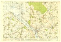
Cape Arid, Western Australia: AAF aeronautical chart
Date
1943-11
Subject
Identifier
macrepo:77059, local: WW2_AirChart_World_1mil_1460
Title
Girls at Belmont Orphanage:
Date
Subject
, --
Identifier
macrepo:104645, local: CPC-01976,
Title
The Isle of Man: Lat. of Douglas Head 54°.9½'. Long. 4°.30'
Date
1794-07-07
Subject
Identifier
macrepo:81559, local: RMC_106786
Title
Plan showing resubdivision of lots nos. 104 to 112 Allen & Matheson Survey
Date
1906-02-06
Subject
Identifier
macrepo:65228
Title
Plan of the road along the centre of the 8th Concession of the Township of East Flamborough[...]
Date
1858-01-30
Subject
Identifier
macrepo:65232
Title
Hatt's Survey Dundas
Date
1820
Subject
Identifier
macrepo:65229, local: RMC_7546/7
Title
A new mapp of Magellan Straights discovered by Capt. John Narbrough: (commander then of his Majesties ship the Sweepstakes) as he sayled through the sade straights
Date
1675
Subject
Identifier
macrepo:26784, local: RMC_107268
Title
Plan of survey of part of lot no 24 in the 2nd conn Flamboro' West containing 18 1/2 acres
Date
1853-11-18
Subject
Identifier
macrepo:63213, local: RMC_7494
Title
England, South West: Ordnance Survey of Great Britain : 1/4-inch to one mile, England & Wales
Date
1943
Subject
Identifier
macrepo:63210, local: WW2_England_Wales_253K_10
Title
A general chart of the Island of Newfoundland with the rocks & soundings
Date
1775-05-10
Subject
Identifier
macrepo:21591, local: RMC_3824
Title
A map of the Island of St. John in the Gulf of St. Laurence divided into counties & parishes: and the lots, as granted by the government, to which are added the soundings round the coast & harbours
Date
1775-04-06
Subject
Identifier
macrepo:21592, local: RMC_3825
Title
Carte de l'Isle Saint Pierre
Date
1763
Subject
Identifier
macrepo:21597, local: RMC_3836
Title
A new map of Canada, also the north parts of New England and New York; with Nova Scotia and Newfound Land
Date
1760
Subject
Identifier
macrepo:26874, local: RMC_107315
Pages
« first
‹ previous
1
2
3
4
5
next ›
last »