Skip to main content
Menu
Home
Digital Archive
McMaster
McMaster Library
Browse
By collection
By language
By location
By subject
About
About
Contact
Contact Us
Digital Preservation Policy
Strategic Framework
Implementation Plan
Copyright Approach for Library Digitization
Home
*
(x)
north
(x)
hamilton
(x)
Search Digital Archive
Search help
Search results
(3,941 - 3,960 of 5,300)
Pages
« first
‹ previous
…
196
197
198
199
200
…
next ›
last »
Title
Design for a gate lodge Burlington Cemetery, sheet no. 3: plan of upper story
Date
1854
Subject
Identifier
macrepo:32283, local: RMC_107105
Title
Design for a gate lodge, Burlington Heights Cemetery, Hamilton, [sheet no. 6]: elevation C
Date
1854
Subject
Identifier
macrepo:32286, local: RMC_107108
Title
Design for a gate lodge Burlington Cemetery, sheet no. 2: plan of ground floor
Date
1854
Subject
Identifier
macrepo:32282, local: RMC_107104
Title
Design for a gate lodge, Burlington Heights Cemetery, Hamilton, sheet no. 4: elevation A
Date
1854
Subject
Identifier
macrepo:32284, local: RMC_107106
Title
Burlington Beach, Wentworth & Halton Counties, Ont. : [sheet] 1
Date
1900-07
Subject
Identifier
macrepo:40681, : HamFIP_1900_Beach_001_index
Title
Burlington Beach, Wentworth & Halton Counties, Ont. : [sheet] 3
Date
1900-07
Subject
Identifier
macrepo:40683, : HamFIP_1900_Beach_003
Title
Burlington Beach, Wentworth & Halton Counties, Ont. : [sheet] 4
Date
1900-07
Subject
Identifier
macrepo:40684, : HamFIP_1900_Beach_004
Title
Map of the Transvaal
Date
1900
Identifier
macrepo:31409, local: RMC_107771
Title
An authentic plan of the River St. Laurence from Sillery, to the Fall of Montmorenci, with the operations of the Siege of Quebec: under the command of Vice-Adml. Saunders & Major Genl. Wolfe down to the 5, Sepr. 1759
Date
1759-09-05
Subject
Québec Campaign, Québec, 1759, Québec Campaign, Québec, 1759--Saint Lawrence River--Québec (Québec)
Identifier
macrepo:31413, local: RMC_106132
Title
Plan de la cataracte de Niagara et de l'isthme qui separe les Lacs Erie et Ontario
Date
1801
Subject
Identifier
macrepo:31421, local: RMC_102129
Title
Plan of the town of Goderich Upper Canada founded by the Canada Company 1829: Lat. 43°. 46m. N. Long. 81°. 53m. W.
Date
1831
Subject
Identifier
macrepo:31418, local: RMC_102781
Title
Sketch of By Town, Ottawa River, founded in 1826
Date
1831
Subject
Identifier
macrepo:31415, local: RMC_102779
Title
Planisfero del mondo nuovo
Date
1688
Subject
Identifier
macrepo:31407, local: RMC_106913
Title
City of Quebec, 1830
Date
1830
Subject
Identifier
macrepo:31416, local: RMC_102780
Title
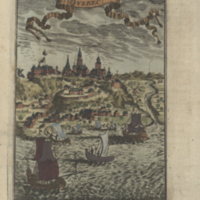
Qvebec
Date
1683
Subject
Identifier
macrepo:31414, local: RMC_106133
Title
Map of the Province of Canada from Lake Superior to the Gulf of St. Lawrence
Date
1857
Subject
Identifier
macrepo:31137, local: RMC_107408
Title
Carte régionale de la province de Québec: comprenant les comtés de Temiscouata, Rimouski, Matane, Bonaventure et Gaspé
Date
1895-12
Subject
Identifier
macrepo:31135, local: RMC_107405
Title
A map of the province of Upper Canada, describing all the new settlements, townships, &c.: with the countries adjacent, from Quebec to Lake Huron
Date
1813
Subject
Identifier
macrepo:31139, local: RMC_107411
Title
A map of the province of Upper Canada, describing all the new settlements, townships, &c.: with the countries adjacent, from Quebec to Lake Huron
Date
1854
Subject
Identifier
macrepo:31141, local: RMC_107414
Title
Partie occidentale de la Nouvelle France ou du Canada
Date
1755
Identifier
macrepo:31375, local: RMC_106572
Pages
« first
‹ previous
…
196
197
198
199
200
…
next ›
last »