Skip to main content
Menu
Home
Digital Archive
McMaster
McMaster Library
Browse
By collection
By language
By location
By subject
About
About
Contact
Contact Us
Digital Preservation Policy
Strategic Framework
Implementation Plan
Copyright Approach for Library Digitization
Home
america
(x)
hamilton
(x)
ontario
(x)
halton
(x)
chile
(x)
Search Digital Archive
Search help
Search results
(2,621 - 2,640 of 3,836)
Pages
« first
‹ previous
…
130
131
132
133
134
…
next ›
last »
Title
[Hamilton, Saltfleet Township, and Queen Elizabeth Way corridor, 1966-05-01] : [Flightline 664-EXP-Photo 86]:
Date
1966-05-01
Subject
Identifier
macrepo:80688, local: AirPhotos_Hamilton_1966_664-EXP-86
Title
[Hamilton, Saltfleet Township, and Queen Elizabeth Way corridor, 1966-05-01] : [Flightline 664-EXP-Photo 115]:
Date
1966-05-01
Subject
Identifier
macrepo:80694, local: AirPhotos_Hamilton_1966_664-EXP-115
Title
Plan of survey of the block lying between Bold, Duke, MacNab, and Bond Streets
Date
1866-06-18
Subject
Identifier
macrepo:65231
Title
Plan of survey of lots in the City of Hamilton property of Mess. Kerr, McLaren, & Street: Copy
Date
1830
Subject
Identifier
macrepo:65235, local: RMC_7535
Title
Plan of the survey of the north end of lot no 19 in fourth conn of Barton into acre lots the property of W.H. Nicolls Esqr.
Date
1854
Subject
Identifier
macrepo:65227
Title
A map of the Island of St. John in the Gulf of St. Laurence divided into counties & parishes: and the lots, as granted by the government, to which are added the soundings round the coast & harbours
Date
1775-04-06
Subject
Identifier
macrepo:21592, local: RMC_3825
Title
A chart of the south-east coast of Newfoundland
Date
1780
Subject
Coasts, Coasts--Newfoundland and Labrador--Placentia Bay Region (N.L.)
Identifier
macrepo:21590, local: RMC_3823
Title
A new map of Canada, also the north parts of New England and New York; with Nova Scotia and Newfound Land
Date
1760
Subject
Identifier
macrepo:26874, local: RMC_107315
Title
Carte de la Baye de Hudson pour servir à l'Histoire generale des voyages
Date
1757
Subject
Identifier
macrepo:26879, local: RMC_107319
Title
Sketch of survey of part of lot no 8 in the 1st concession of the "Township of Barton".: Containing 123 1/2 acres
Date
1862-10-02
Subject
Identifier
macrepo:65206, local: RMC_7501
Title
Sketch of property southside of York Street in Hamilton: Taken from Title Deeds, dated May 3rd, 1848
Date
1848-05-03
Subject
Identifier
macrepo:65209, local: RMC_7520
Title
Barton
Date
1846-11
Subject
Identifier
macrepo:65208, local: RMC_7519
Title
Plan of Park and other lots in John Hill’s Survey, Barton 1846
Date
1848
Subject
Identifier
macrepo:65212
Title
A sketch of lot 16 in the 5th Con of Barton
Date
1852-07
Subject
Identifier
macrepo:65215, local: RMC_7482
Title
Survey for a ship canal around the Falls of Niagara
Date
1835
Subject
Identifier
macrepo:22622, local: RMC_6189
Title
[Map of Hamilton, Main and Emerald Streets]
Date
1810
Subject
Identifier
macrepo:70453, local: RMC_7567
Title
Map of country south of Harbin, to illustrate the campaign in Manchuria
Date
1905-05
Subject
Russo-Japanese War, 1904-1905, Russo-Japanese War, 1904-1905--Harbin Region (China)--Manchuria (China)
Identifier
macrepo:70443, local: Misc_SouthofHarbin_420k
Title
Carte de la Baye de Hudson, pour servir à l'Histoire générale des voyages
Date
1757
Subject
Identifier
macrepo:32220, local: RMC_107031
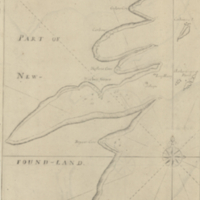
Title
Harbor Grace
Date
1755
Subject
Identifier
macrepo:23908, local: RMC_8904
Title
North America : sheet I. Nova-Scotia with part of New Brunswick and Lower Canada
Date
1832-12-15
Subject
Identifier
macrepo:26988, local: RMC_107338
Pages
« first
‹ previous
…
130
131
132
133
134
…
next ›
last »