Skip to main content
Menu
Home
Digital Archive
McMaster
McMaster Library
Browse
By collection
By language
By location
By subject
About
About
Contact
Contact Us
Digital Preservation Policy
Strategic Framework
Implementation Plan
Copyright Approach for Library Digitization
Home
america
(x)
niagara
(x)
saltfleet
(x)
hamilton
(x)
region
(x)
ont
(x)
footbal
(x)
Search Digital Archive
Search help
Search results
(81 - 100 of 1,023)
Pages
« first
‹ previous
…
3
4
5
6
7
…
next ›
last »
Title
Sketch of survey lots in the City of Hamilton, the property of Robert N. Law, Esqr.
Date
1853-06-10
Subject
Identifier
macrepo:61979
Title
[Views of Hamilton from the northwest, 1955] : [photo C248]
Date
1955
Subject
Identifier
macrepo:71399, local: AirPhotos_Hamilton_1955_C248
Title
[Hamilton industrial area, 1956] : [flightline A15550, photo 9]
Date
1956-10-04
Subject
Identifier
macrepo:71403, local: AirPhotos_Hamilton_1956_A15550-9
Title
[Hamilton Metropolitan Area, 1951-04-13] : [Photo 1C]:
Date
1951-04-13
Subject
Identifier
macrepo:72282, local: AirPhotos_Hamilton_1951-1C
Title
[Hamilton Metropolitan Area, 1951-04-13] : [Photo 2B]:
Date
1951-04-13
Subject
Identifier
macrepo:72305, local: AirPhotos_Hamilton_1951-2B
Title
[Hamilon Area, 1950-06] : [Flightline A13067-Photo 61]:
Date
1950-06
Subject
Identifier
macrepo:72251, local: AirPhotos_Hamilton_1950_A13067-61
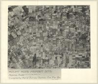
Title
Mount Hope Airport Site
Date
1939-11
Subject
British Commonwealth Air Training Plan, British Commonwealth Air Training Plan--Canada--World War, 1939-1945
Identifier
macrepo:89715, local: MountHope_AirportSite
Title
Sketch of the survey of 5 lots containing 5 acres each with the exception of no 5 which contains 4 a. [illegible details]: being a part of the northerly half of lot no 12 in the 4th Concession of the Township of Barton
Date
1871
Subject
Identifier
macrepo:76548, local: RMC_7733
Title
Sketch of survey of lots nos. 10, 11 and 12 in the Fourth Conn. of Township of Barton
Date
1850-04-20
Subject
Identifier
macrepo:74501, local: RMC_7642
Title
Plan of survey of lots in the City of Hamilton between Concession and Markland Streets being part of lot 16 in 3 Concession: Township of Barton the property of Alexander McInnes Esq
Date
1872-11-5
Subject
Identifier
macrepo:74549, local: RMC_7651
Title
[Map of Dundas, east of Sydenham Street]
Date
1850
Subject
Identifier
macrepo:75528, local: RMC_7736
Title
Plan of the south ends of lots nos 13 and 14 in the 4th Conn of Barton, divided into 59 lots of about one acre each: including Sheriff Thomases' private survey
Date
1853-06-23
Subject
Identifier
macrepo:74448, local: RMC_7643
Title
Plan of parks survey upon lot no. 9 in First Concession of the Township of Barton : [northwest sheet]
Date
1854-01
Subject
Identifier
macrepo:75210, local: RMC_7684NW
Title
Copy of part of Flamborough East (no 10)
Date
1863-04-14
Subject
Identifier
macrepo:75477, local: RMC_7708
Title
Plan of John Fergusons property
Date
1871-09-19
Subject
Identifier
macrepo:74455, local: RMC_7645
Title
[Hamilton Mountain, 1965] : [Flightline A18949-Photo 28]:
Date
1965
Subject
Identifier
macrepo:79832, local: AirPhotos_Hamilton_1965_A18949-28
Title
[Hamilton Mountain, 1965] : [Flightline A18949-Photo 29]:
Date
1965
Subject
Identifier
macrepo:79830, local: AirPhotos_Hamilton_1965_A18949-29
Title
[Hamilton Mountain, 1965] : [Flightline A18949-Photo 26]:
Date
1965
Subject
Identifier
macrepo:79834, local: AirPhotos_Hamilton_1965_A18949-26
Title
[Parts of Wentworth County, 1961-04-20] : [Flightline A17288-Photo 47]:
Date
1961-04-20
Subject
Identifier
macrepo:80189, local: AirPhotos_Hamilton_1961_A17288-47
Title
[Parts of Wentworth County, 1961-04-20] : [Flightline A17288-Photo 54]:
Date
1961-04-20
Subject
Identifier
macrepo:80187, local: AirPhotos_Hamilton_1961_A17288-54
Pages
« first
‹ previous
…
3
4
5
6
7
…
next ›
last »