Skip to main content
Menu
Home
Digital Archive
McMaster
McMaster Library
Browse
By collection
By language
By location
By subject
About
About
Contact
Contact Us
Digital Preservation Policy
Strategic Framework
Implementation Plan
Copyright Approach for Library Digitization
Home
america
(x)
chaplain
(x)
halton
(x)
univers
(x)
latitude
(x)
river
(x)
Search Digital Archive
Search help
Search results
(1,281 - 1,300 of 1,311)
Pages
« first
‹ previous
…
62
63
64
65
66
next ›
last »
Title
Sketch of Beach: applied for by the Board of Water Commissioners for the City of Hamilton
Date
1881
Subject
Identifier
macrepo:70903, local: RMC_7618
Title
Lake Maracaibo, Venezuela: AAF aeronautical chart
Date
1944-10
Subject
Aeronautical charts, Aeronautical charts
Identifier
macrepo:76937, local: WW2_AirChart_World_1mil_0770
Title
A plan of Success Bay in Strait Le Maire ; A chart of the S.E. part of Terra del Fuego including Strait Le Maire....
Date
1769
Subject
Identifier
macrepo:25563, local: RMC_107212
Title
A plan of Success Bay in Strait Le Maire ; A chart of the S.E. part of Terra del Fuego including Strait Le Maire....
Date
1769
Subject
Identifier
macrepo:26707, local: RMC_107251
Title
Kaart van de Good Success Baai in de Straat van Le Maire: [and] Kaart van het Z.O. gedeelte van het Vuur Land de Straat Le Maire en een gedeelte van Staaten-Land. door Luit. J. Cook 1769
Date
1794
Subject
Identifier
macrepo:24800, local: RMC_107196
Title
A map of the discoveries made by Capts. Cook & Clerke, in the years 1778 & 1779: between the eastern coast of Asia and the western coast of North America, when they attempted to navigate the North Sea....
Date
1785-01-01
Subject
Cook, James, 1728-1779--Clerke, Charles, 1741-1779--North Pacific Ocean--Pacific Coast (North
America
)--Pacific Coast (Asia)
Identifier
macrepo:21771, local: RMC_4172
Title
A map of Chili, Patagonia, La Plata, and ye south part of Brasil
Date
1732
Subject
Identifier
macrepo:24301, local: RMC_107177
Title
Saltfleet
Date
1846-11
Subject
Identifier
macrepo:58542, local: RMC_7500
Title
Tabula Magellanica qua Tierræ del Fuego, cum celeberrimis fretis a F. Magellano et I. le Maire detectis: novissima et accuratissima descriptio exhibetur
Date
1652
Subject
Identifier
macrepo:80970, local: RMC_107227r
Title
Counties of Lanark and Renfrew, Carleton and Leeds, and Grenville
Date
1852
Subject
Identifier
macrepo:81569, local: RMC_6191i
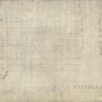
Title
[Map of Dundas]
Date
1810
Subject
Identifier
macrepo:70161, local: RMC_7560A
Title
Tracing of plan showing the position of lots comprising the Village of Freelton, Township of West Flamborough: County of Wentworth, C.W.
Date
1848
Subject
Identifier
macrepo:70127, local: RMC_7568
Title
[Plan of the Village of Inverness in Burlington, Ontario]
Date
1830
Subject
Identifier
macrepo:70139, local: RMC_7559B
Title
Tabula Magellanica qua Tierræ del Fuego: cum celeberrimis fretis a F. Magellano et I. le Maire detectis, novissima et accuratissima descriptio exhibetur
Date
1647
Subject
Identifier
macrepo:76970, local: RMC_107061r
Title
Counties of Prescott and Russell, and Stormont, Dundas, and Glengarry
Date
1852
Subject
Identifier
macrepo:81564, local: RMC_6191d
Title
Plan of the road along the centre of the 8th Concession of the Township of East Flamborough[...]
Date
1858-01-30
Subject
Identifier
macrepo:65232
Title
A new mapp of Magellan Straights discovered by Capt. John Narbrough: (commander then of his Majesties ship the Sweepstakes) as he sayled through the sade straights
Date
1675
Subject
Identifier
macrepo:26784, local: RMC_107268
Title
Grand Trunk Railway: Connection between the G.W. and N & NW Divisions, Township of Saltfleet
Date
1888-11-21
Subject
Identifier
macrepo:70586, local: RMC_7579
Title
Plan showing lots numbers 1, 2 and 3 in the subdivision of part of lot no.1 in the Broken Front Concession: of the Township of East Flamborough in the County of Wentworth. The property of John J. Filman
Date
1897-03-25
Subject
Identifier
macrepo:70426, local: RMC_7565
Title
Carte de la partie de l'ocean vers l'equateur entre les cotes d'Afrique et d'Amerique: où la situàtion des isles, bancs, et vigies, montre qu'elles peuventêtre soit la disposition du fonds de la mer....
Date
1737-09
Subject
Identifier
macrepo:26671, local: RMC_107241
Pages
« first
‹ previous
…
62
63
64
65
66
next ›
last »
![[Map of Dundas]](/islandora/object/macrepo%3A70161/datastream/TN/view)