Skip to main content
Menu
Home
Digital Archive
McMaster
McMaster Library
Browse
By collection
By language
By location
By subject
About
About
Contact
Contact Us
Digital Preservation Policy
Strategic Framework
Implementation Plan
Copyright Approach for Library Digitization
Home
europe
(x)
wale
(x)
itali
(x)
germany
(x)
1914
(x)
world
(x)
wales
(x)
midlands
(x)
of
(x)
isle
(x)
Search Digital Archive
Search help
Search results
(1 - 5 of 5)
Title
Strait of Dover: Ordnance Survey of Great Britain (Aeronautical map) 1:500,000 R.A.F. (War)
Date
1945
Subject
Aeronautical charts, Aeronautical charts--Great Britain
Identifier
macrepo:70065, local: WW2_GreatBritain_500k_8
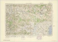
Title
[Weald of Kent]
Date
1940
Subject
Topographic maps, Topographic maps--England--Wales
Identifier
macrepo:66526
Title
Gloucester & Forest of Dean
Date
1940
Subject
Topographic maps, Topographic maps--England--Wales
Identifier
macrepo:66416
Title
Weald of Kent
Date
1940
Subject
Topographic maps, Topographic maps--England--Wales
Identifier
macrepo:66459
Title
England, South West: Ordnance Survey of Great Britain : 1/4-inch to one mile, England & Wales
Date
1943
Subject
Identifier
macrepo:63210, local: WW2_England_Wales_253K_10
![[Weald of Kent]](/islandora/object/macrepo%3A66526/datastream/TN/view)