Search results
Pages
-
-
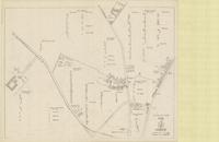
Title
-
Plan of camp H.Q. Corps
-
Date
-
1917
-
Subject
-
World War, 1914-1918, World War, 1914-1918--Belgium
-
Identifier
-
macrepo:71417, local: PC0579B
-
-
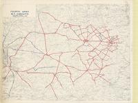
Title
-
Fourth Army M.T. circuits
-
Date
-
1918-01-26
-
Subject
-
World War, 1914-1918, World War, 1914-1918--Belgium--France
-
Identifier
-
macrepo:74382, local: PC0822
Pages