Skip to main content
Menu
Home
Digital Archive
McMaster
McMaster Library
Browse
By collection
By language
By location
By subject
About
About
Contact
Contact Us
Digital Preservation Policy
Strategic Framework
Implementation Plan
Copyright Approach for Library Digitization
Home
hamilton
(x)
golden
(x)
wentworth
(x)
ont
(x)
longitude
(x)
1
(x)
of
(x)
Search Digital Archive
Search help
Search results
(1 - 12 of 12)
Title
Plan of lots I to IX both inclusive in the Vth and VIth Concessions of Saltfleet: Surveyed under instructions from the Honble. the Commr. of Crown Lands
Date
1860-06-04
Subject
Identifier
macrepo:70742, local: RMC_7608
Title
Plan of Lawrence Park: being a subdivision of a part of lot 56, con. 1., Tp. of Ancaster
Date
1913-10-10
Subject
Identifier
macrepo:70140, local: RMC_7563
Title
Plan showing resubdivision of lots nos. 104 to 112 Allen & Matheson Survey
Date
1906-02-06
Subject
Identifier
macrepo:65228
Title
Hatt's Survey Dundas
Date
1820
Subject
Identifier
macrepo:65229, local: RMC_7546/7
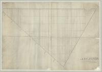
Title
Ancaster
Date
1846
Subject
Identifier
macrepo:70040, local: RMC_7562
Title
Plan of survey of park-lots laid out on lot no. 5 in the 1st and B.F. Cons. in the Township of Saltfleet
Date
1893-11-22
Subject
Identifier
macrepo:70496, local: RMC_7573
Title
Plan No. 1 Ancaster
Date
1846
Subject
Identifier
macrepo:70491, local: RMC_7580
Title
Plan of survey of park lots in the Township of Saltfleet: being the subdivision of part of lots 29, 30, & 31 in the 1st concession part of the estate of the late William Blaikie
Date
1858
Subject
Identifier
macrepo:70641, local: RMC_7610
Title
Plan showing lots numbers 1, 2 and 3 in the subdivision of part of lot no.1 in the Broken Front Concession: of the Township of East Flamborough in the County of Wentworth. The property of John J. Filman
Date
1897-03-25
Subject
Identifier
macrepo:70426, local: RMC_7565
Title
Plan of Ontario: 10 miles east of Hamilton, according to the survey made by T.A. Blyth, P.L.S.
Date
1869-10-20
Subject
Identifier
macrepo:70477, local: RMC_7572
Title
[Map of planned village at present-day Winona, Ontario]
Date
1820
Subject
Identifier
macrepo:70834, local: RMC_7611
Title
[Map of Dundas]
Date
1810
Subject
Identifier
macrepo:70161, local: RMC_7560A
![[Map of Dundas]](/islandora/object/macrepo%3A70161/datastream/TN/view)