Skip to main content
Menu
Home
Digital Archive
McMaster
McMaster Library
Browse
By collection
By language
By location
By subject
About
About
Contact
Contact Us
Digital Preservation Policy
Strategic Framework
Implementation Plan
Copyright Approach for Library Digitization
Home
eng
(x)
europ
(x)
burlington
(x)
region
(x)
canada
(x)
Search Digital Archive
Search help
Search results
(1 - 20 of 447)
Pages
1
2
3
4
5
…
next ›
last »
Title
A map of North America from the latest surveys and maps
Date
1768
Subject
Identifier
macrepo:76554, local: RMC_106457
Title
[Greater Hamilton Area, from Caledonia to Vineland, 1934-07-09] : [Flightline A4809-Photo 19]:
Date
Subject
Identifier
macrepo:72314, local: AirPhotos_Hamilton_1934_A4809-19
Title
[Greater Hamilton Area, from Caledonia to Vineland, 1934-07-01] : [Flightline A4701-Photo 24]:
Date
Subject
Identifier
macrepo:72308, local: AirPhotos_Hamilton_1934_A4701-24
Title
[Greater Hamilton Area, from Caledonia to Vineland, 1934-07-09] : [Flightline A4753-Photo 76]:
Date
Subject
Identifier
macrepo:71881, local: AirPhotos_Hamilton_1934_A4753-76
Title
[Greater Hamilton Area, from Caledonia to Vineland, 1934-07-01] : [Flightline A4702-Photo 20]:
Date
Subject
Identifier
macrepo:71874, local: AirPhotos_Hamilton_1934_A4702-20
Title
[Regional Municipality of Hamilton-Wentworth and surrounding area, 1954] : [Flightline 4309-Photo 8]:
Date
1954
Subject
Identifier
macrepo:73050, local: AirPhotos_Hamilton_1954-1955_4309-8
Title
[Regional Municipality of Hamilton-Wentworth and surrounding area, 1954] : [Flightline 4313-Photo 121]:
Date
1954
Subject
Identifier
macrepo:73052, local: AirPhotos_Hamilton_1954-1955_4313-121
Title
[Regional Municipality of Hamilton-Wentworth and surrounding area, 1954] : [Flightline 4323-Photo 177]:
Date
1954
Subject
Identifier
macrepo:73045, local: AirPhotos_Hamilton_1954-1955_4323-177
Title
The discoveries of the expedition under the command of Captain Franklin R.N. near the mouth of the Mackenzie River: and on the sea coast east & west, A.D. 1825-26
Date
1828-04
Subject
Identifier
macrepo:21587, local: RMC_2583
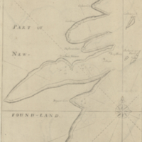
Title
A chart of the south-east coast of Newfoundland
Date
1780
Subject
Coasts, Coasts--Newfoundland and Labrador--Placentia Bay Region (N.L.)
Identifier
macrepo:21590, local: RMC_3823
Title
A new map of Canada, also the north parts of New England and New York; with Nova Scotia and Newfound Land
Date
1760
Subject
Identifier
macrepo:26874, local: RMC_107315
Title
Map showing the different railways by which the eastern townships of Canada East may be reached
Date
1880
Subject
Railroads, Railroads--Ontario--Eastern Townships (Québec)--Northeastern States
Identifier
macrepo:26872, local: RMC_107314
Title
Comparative map of the Ottawa and St Lawrence waterways
Date
1895
Subject
Identifier
macrepo:26994, local: RMC_107340
Title
North America : sheet III. Upper Canada with parts of New-York, Pennsylvania and Michigan
Date
1832-09-01
Subject
Identifier
macrepo:27002, local: RMC_107344
Title
North America : sheet IV Lake Superior, reduced from the Admiralty Survey
Date
1832-11-01
Subject
Identifier
macrepo:26992, local: RMC_107339
Title
Harbor Grace
Date
1755
Subject
Identifier
macrepo:23908, local: RMC_8904
Title
Canada West formerly Upper Canada
Date
1850
Subject
Identifier
macrepo:26985, local: RMC_107335
Title
Upper Canada
Date
1842
Subject
Identifier
macrepo:26986, local: RMC_107336
Title
Canada West formerly Upper Canada
Date
1849
Subject
Identifier
macrepo:26983, local: RMC_107334
Title
Ottawa-Gatineau District, Ontario - Quebec
Date
1953
Subject
Identifier
macrepo:74378, local: WWII_Canada_Ottawa_Gatineau_031_G05-G02_1953
Pages
1
2
3
4
5
…
next ›
last »