Skip to main content
Menu
Home
Digital Archive
McMaster
McMaster Library
Browse
By collection
By language
By location
By subject
About
About
Contact
Contact Us
Digital Preservation Policy
Strategic Framework
Implementation Plan
Copyright Approach for Library Digitization
Home
eng
(x)
europ
(x)
wale
(x)
europ
(x)
germany
(x)
germany
(x)
austria
(x)
Search Digital Archive
Search help
Search results
(1 - 20 of 444)
Pages
1
2
3
4
5
…
next ›
last »
Title
Frankfurt, Louvain Chain: Lattice Topographical Map
Date
1944-09
Subject
Identifier
macrepo:82170, local: WW2_Lattice_500k_Frankfurt_LouvainChain
Title
Frankfurt, Reims Chain: Lattice Topographical Map
Date
1944-10
Subject
Identifier
macrepo:82175, local: WW2_Lattice_500k_Frankfurt_ReimsChain
Title
Berlin, Cologne Chain: Lattice Topographical Map
Date
1943
Subject
Identifier
macrepo:82173, local: WW2_Lattice_500k_Berlin_CologneChain
Title
Villingen-Sigmaringen-Tuttlingen-Überlingen: Germany 1:100,000 Series
Date
1943
Subject
Identifier
macrepo:75461, local: ww2_Germany_100k_152a
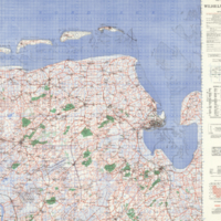
Title
Wilhelmshaven
Date
1944
Subject
Identifier
macrepo:20475, ww2_CentralEurope_100k_L2_ED1
Title
London - Berlin: Cologne fixing chart
Date
1944-08
Subject
Identifier
macrepo:82165, local: WW2_Radar_1mil_London-Berlin_CologneChart
Title
Bohmer Forest, Germany: AAF aeronautical chart
Date
1944-02
Subject
Aeronautical charts, Aeronautical charts
Identifier
macrepo:76620, local: WW2_AirChart_World_1mil_0231
Title
English Channel, copy 2: Plotting series
Date
1944-07
Subject
Identifier
macrepo:82152, local: WW2_Plotting_1mil_EnglishChannel_2
Title
Coburg
Date
1944
Subject
Identifier
macrepo:21607, ww2_CentralEurope_100k_S5_ED1
Title
Kiel Canal, Germany: AAF aeronautical chart
Date
1943-09
Subject
Aeronautical charts, Aeronautical charts
Identifier
macrepo:76597, local: WW2_AirChart_World_1mil_0170
Title
London - Munchen: Reims fixing chart
Date
1944-12
Subject
Identifier
macrepo:82169, local: WW2_Radar_1mil_London-Munchen_ReimsChart
Title
A reduced map of the Empire of Germany, Holland, the Netherlands, Switzerland, the Grisons, Italy, Sicily, Corsica, and Sardinia
Date
1800-03-12
Subject
Identifier
macrepo:78197, local: RMC_9453
Title
Berlin, Ruhr Chain: Lattice Topographical Map
Date
1943
Subject
Identifier
macrepo:82177, local: WW2_Lattice_500k_Berlin_RuhrChain
Title
Bremen, Louvain Chain: Lattice Topographical Map
Date
1944-09
Subject
Identifier
macrepo:82189, local: WW2_Lattice_500k_Bremen_LouvainChain
Title
Berlin, Reims Chain: Lattice Topographical Map
Date
1944-10
Subject
Identifier
macrepo:82174, local: WW2_Lattice_500k_Berlin_ReimsChain
Title
Gulf of Danzig, Poland-Germany: AAF aeronautical chart
Date
1943-09
Subject
Aeronautical charts, Aeronautical charts
Identifier
macrepo:76596, local: WW2_AirChart_World_1mil_0169
Title
War map : specially indicating scenes where Canadian troops distinguished themselves
Date
1918
Subject
World War, 1914-1918, World War, 1914-1918--France
Identifier
macrepo:76369, local: Montreal_Star_War_Map_r
Title
The Landgraviate of Hesse Cassel with part of Wetteravia and the adjacent countries: Taken from a large drawing found in the cabinet of the Landgrave of Hesse and corrected from actual surveys
Date
1760
Subject
Identifier
macrepo:78159, local: RMC_9163
Title
Johnston's chart of the Baltic Sea, German Ocean & English Channel: with the adjoining countries showing the principal lines of railway communication to the coasts of Northern Europe
Date
1854
Subject
Identifier
macrepo:76359, local: RMC_5452
Title
English Channel: Plotting series
Date
1944-07
Subject
Identifier
macrepo:81934, local: WW2_Plotting_1mil_EnglishChannel
Pages
1
2
3
4
5
…
next ›
last »