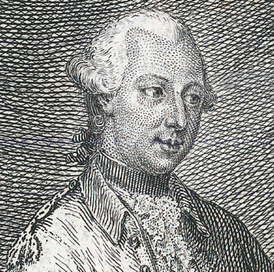
Honourable Robert Edward Clifford, 1767-1817 (RMC)
Pages
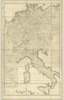
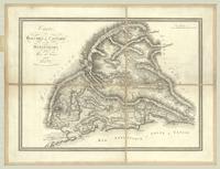
- A reduced map of the Empire of Germany, Holland, the Netherlands, Switzerland, the Grisons, Italy, Sicily, Corsica, and Sardinia
![Atlas von Liefland oder von den beyden Gouvernementer und Herzogthümern Lief-und Ehstland und der Provinz Oesel...[13 atlas plates]](http://digitalarchive.mcmaster.ca/islandora/object/macrepo%3A82393/datastream/TN/view)
- Atlas von Liefland oder von den beyden Gouvernementer und Herzogthümern Lief-und Ehstland und der Provinz Oesel...[13 atlas plates]

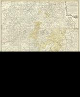
- Basse Partie de la Westphalie, contenant la Principaute d'ost-frise la Partie inferieure des Eveches de Munster et D'osnabruck

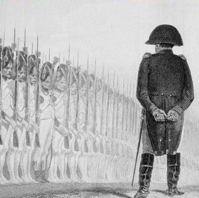
- Battle of Waterloo, June 18th, 1815
- Carte chorographique des Pays-Bas Autrichiens (1 map on 12 sheets, orignally 25 sheets)
- Carte contenant l'etendue ... de Perpignan... (1 map on 6 sheets)
- Carte de France (1 map on 180 sheets)
![Carte de la Moldavie [1 map on 2 sheets]](http://digitalarchive.mcmaster.ca/islandora/object/macrepo%3A86541/datastream/TN/view)
- Carte de la Moldavie [1 map on 2 sheets]

- Carte des Bords du Rhin
- Carte des bouches de Cattaro et du Montenegro

- Carte tres particuliere du Pays de Waase

- City Fortifications and Environs

- City View and Plan, Inset Maps (set of 48)
![Das Konigreich Baiern nebst den angrenzenden Landern...[The Kingdom of Bavaria, together with the adjoining lands...]](http://digitalarchive.mcmaster.ca/islandora/object/macrepo%3A78198/datastream/TN/view)
- Das Konigreich Baiern nebst den angrenzenden Landern...[The Kingdom of Bavaria, together with the adjoining lands...]
- Delineatio Geographica generalis, comprehendens VI. Foliis Singulos Principatvs, Comitatvs, Ditiones, Dynastias omnes, quotquot

- Deutschland und der gröste Theil der umliegenden Staaten, oder Mittel=Europa in 35 Blättern

- Egyptian and Syrian Campaign, 1798-1801

- Etats de la Maison de Brunswick-Lunenburg, et deleurs Frontieres
- Exactissima statuum totius ducatus Bavariae... (1 map in 9 parts)
- Grand theatre de la guerre sur les frontieres de France & d'Allemagne
Pages