Skip to main content
Menu
Home
Digital Archive
McMaster
McMaster Library
Browse
By collection
By language
By location
By subject
About
About
Contact
Contact Us
Digital Preservation Policy
Strategic Framework
Implementation Plan
Copyright Approach for Library Digitization
Home
europe
(x)
europe
(x)
england
(x)
great
(x)
devon
(x)
essex
(x)
scotland
(x)
Search Digital Archive
Search help
Search results
(1 - 7 of 7)
Title
The Border: Ordnance Survey of Great Britain (aeronautical map) 1:500,000
Date
1944
Subject
Identifier
macrepo:81945, local: WW2_Aero_500k_Border
Title
Cruchley's improved geographical companion throughout England & Wales including part of Scotland
Date
1822-09-09
Subject
Identifier
macrepo:78032, local: RMC_4290
Title
A modern map of the post roads of England and Wales, with part of Scotland: Drawn from the latest surveys; corrected & improved by the best authorities
Date
1780
Subject
Identifier
macrepo:78031, local: RMC_4289
Title
Bowles's British geographical amusement, or game of geography; in a most compleat and elegant tour thro England, Wales...: and the adjoining parts of Scotland & Ireland. London: Printed for the proprietor Carington Bowles. No 69 St. Pauls Ch: Yard....
Date
1780
Subject
Identifier
macrepo:80919, local: RMC_4340
Title
Irish Sea: Ordnance Survey of Great Britain : 1/4-inch to one mile, England & Wales
Date
1944
Subject
Identifier
macrepo:61974, local: WW2_England_Wales_253K_02A
Title
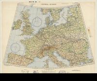
Central Europe
Date
1943
Subject
Identifier
macrepo:70685, local: Misc_CentralEurope_4mil
Title
England - west coast : the Firth of Solway
Date
1933
Subject
Identifier
macrepo:26730, local: RMC_107263