Skip to main content
Menu
Home
Digital Archive
McMaster
McMaster Library
Browse
By collection
By language
By location
By subject
About
About
Contact
Contact Us
Digital Preservation Policy
Strategic Framework
Implementation Plan
Copyright Approach for Library Digitization
Home
europe
(x)
itali
(x)
topograph
(x)
nord
(x)
1945
(x)
spain
(x)
poland
(x)
germany
(x)
Search Digital Archive
Search help
Search results
(4,781 - 4,799 of 4,799)
Pages
« first
‹ previous
…
236
237
238
239
240
Title
Situation map 5A, new series : [St. Quentin Region, 1917]
Date
1917-08-14
Subject
World War, 1914-1918, World War, 1914-1918--France
Identifier
macrepo:73919, local: PC0760
Title
[Second] Army area map, no. 7 : index to panoramas
Date
1918-08-31
Subject
World War, 1914-1918, World War, 1914-1918--Belgium--France
Identifier
macrepo:74000, local: PC0798ww1map
Title
[Second] Army area no. 1 : Second Army lines of defence, 29th April 1918
Date
1918-04-30
Subject
World War, 1914-1918, World War, 1914-1918--Belgium--France
Identifier
macrepo:74001, local: PC0799ww1map
Title
[Second] Army area map, no. 6 : railways (secret)
Date
1918-06-12
Subject
World War, 1914-1918, World War, 1914-1918--Belgium--France
Identifier
macrepo:73998, local: PC0796
Title
Army area map no. 10 : army training areas map, October, 1918
Date
1918-10
Subject
World War, 1914-1918, World War, 1914-1918--France
Identifier
macrepo:74109, local: PC0806
Title
[St. Omer Region]: [Belgium & France]
Date
1915
Subject
World War, 1914-1918, World War, 1914-1918--France--Belgium
Identifier
macrepo:70096, local: PC0222
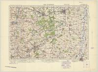
Title
The Dukeries
Date
1940
Subject
Topographic maps, Topographic maps--England--Wales
Identifier
macrepo:66367
Title
England - west coast : the Firth of Solway
Date
1933
Subject
Identifier
macrepo:26730, local: RMC_107263
Title
South Russia: Asia, scale 1:4,000,000
Date
1941
Subject
Identifier
macrepo:70609, local: WW2_Asia_4mil_20
Title
Pico, San Jorge and Graciosa: Azores 1:100,000
Date
1942
Subject
Identifier
macrepo:70830, local: Misc_Azores_Pico_100k
Title
Gulf of Aden: Asia, scale 1:4,000,000
Date
1934
Subject
Identifier
macrepo:70656, local: WW2_Asia_4mil_44
Title
Persian Gulf: Asia, scale 1:4,000,000
Date
1941
Subject
Identifier
macrepo:70636, local: WW2_Asia_4mil_32
Title
[Saint-Quentin Canal, Canal de l'Oise à la Sambre, south of Saint-Quentin]: [Belgium & France]
Date
1918-01-13
Subject
World War, 1914-1918, World War, 1914-1918--France--Belgium
Identifier
macrepo:70741, local: PC0469
Title
[Saint-Quentin Canal, Canal de l'Oise à la Sambre, south of Saint-Quentin : front line area]: [Belgium & France]
Date
1918-01-05
Subject
World War, 1914-1918, World War, 1914-1918--France--Belgium
Identifier
macrepo:70746, local: PC0471
Title
[Saint-Quentin Canal, Canal de l'Oise à la Sambre, south of Saint-Quentin]: [Belgium & France]
Date
1918-01-13
Subject
World War, 1914-1918, World War, 1914-1918--France--Belgium
Identifier
macrepo:70739, local: PC0468
Title
Carte de Northumberland, Durham, Cumberland, Westmoreland, et l'Ile de Man
Date
1729
Subject
Identifier
macrepo:24795, local: RMC_107190
Title
[Angliae]
Date
1595
Subject
Identifier
macrepo:32290, local: RMC_107119
Title
A chart of the Banks of Newfoundland, drawn from a great number of hydrographical surveys: chiefly from those of Chabert, Cook and Fleurieu, connected and ascertained by astronomical observations
Date
1787-03-26
Subject
Identifier
macrepo:81603, local: RMC_8805
Title
[Lodi, Adda River Region]: [War of the Polish Succession, 1733-1738]
Date
1734
Subject
Identifier
macrepo:81923, local: RMC_102960
Pages
« first
‹ previous
…
236
237
238
239
240
![[Angliae]](/islandora/object/macrepo%3A32290/datastream/TN/view)