Skip to main content
Menu
Home
Digital Archive
McMaster
McMaster Library
Browse
By collection
By language
By location
By subject
About
About
Contact
Contact Us
Digital Preservation Policy
Strategic Framework
Implementation Plan
Copyright Approach for Library Digitization
Home
canada
(x)
war
(x)
latitud
(x)
saint
(x)
bai
(x)
d'anticosti
(x)
america
(x)
labrador
(x)
Search Digital Archive
Search help
Search results
(1 - 20 of 31)
Pages
1
2
next ›
last »
Title
A new topographical map of the province of lower Canada: Compiled from all the former as well as the latest surveys taken by order of the Provincial Government ...
Date
1803-01-01
Subject
Identifier
macrepo:81086, local: RMC_9287
Title
Saint-Guillaume-D'upton, Quebec
Date
1971-01
Subject
--
Canada
Identifier
macrepo:82303, local: OctCrisis_031H15_1971_ed05
Title
A new map of Canada, also the north parts of New England and New York; with Nova Scotia and Newfound Land
Date
1760
Subject
Identifier
macrepo:26874, local: RMC_107315
Title
This topographical map of the districts of Quebec, Three Rivers, St. Francis and Gaspé, Lower Canada: exhibiting the new civil division of the districts into counties pursuant to a recent act of the Provincial Legislature
Date
1831-05-02
Subject
Identifier
macrepo:81914, local: RMC_102982_n
Title
This topographical map of the districts of Quebec, Three Rivers, St. Francis and Gaspé, Lower Canada: exhibiting the new civil division of the districts into counties pursuant to a recent act of the Provincial Legislature
Date
1831-05-02
Subject
Identifier
macrepo:81917, local: RMC_102982_nw
Title
This topographical map of the districts of Quebec, Three Rivers, St. Francis and Gaspé, Lower Canada: exhibiting the new civil division of the districts into counties pursuant to a recent act of the Provincial Legislature
Date
1831-05-02
Subject
Identifier
macrepo:81920, local: RMC_102982_se
Title
This topographical map of the districts of Quebec, Three Rivers, St. Francis and Gaspé, Lower Canada: exhibiting the new civil division of the districts into counties pursuant to a recent act of the Provincial Legislature
Date
1831-05-02
Subject
Identifier
macrepo:81913, local: RMC_102982_s
Title
Saint Anicet, ON. 1:25,000. Map sheet 031G01F, [ed. 1], 1974:
Date
1974
Subject
, --
Identifier
macrepo:88648, local: HTDP25K031G01f_1974
Title
Plan of the military & naval operations, under the command of the immortal Wolfe, & Vice Admiral Saunders, before Quebec
Date
1841-05-01
Subject
Identifier
macrepo:31112, local: RMC_107401
Title
Part of Lake Ontario and the River St. Lawrence from an actual survey
Date
1818-05-11
Subject
Identifier
macrepo:31410, local: RMC_103101
Title
A map of the Island of St. John in the Gulf of St. Laurence divided into counties & parishes: and the lots, as granted by the government, to which are added the soundings round the coast & harbours
Date
1775-04-06
Subject
Identifier
macrepo:21592, local: RMC_3825
Title
A chart of the Gulf of St. Laurence: composed from a great number of actual surveys and other materials, regulated and connected by astronomical observations
Date
1786-08-01
Subject
Identifier
macrepo:81938, local: RMC_8806
Title
The harbours of Rishibucto & Buctush on the west shore of the Gulph of St. Lawrence
Date
1778-01-26
Subject
Identifier
macrepo:21760, local: RMC_4160
Title
A chart of the Magdalen Islands in the Gulf of St. Laurence surveyed in 1765
Date
1794
Subject
Identifier
macrepo:21756, local: RMC_4156
Title
Plan du Port Dauphin et de sa rade avec l'entrée de Labrador
Date
1744
Subject
Identifier
macrepo:21710, local: RMC_4148
Title
Baye Ste. Anne ou le Port Dauphin dans l'Isle Royale
Date
1764
Subject
Identifier
macrepo:21711, local: RMC_4149
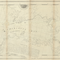
Title
Charlotte Bay
Date
1776-02-11
Subject
Identifier
macrepo:22609, local: RMC_4993
Title
Carte du cours du fleuve de St. Laurent depuis son embouchure jusqu'au dessus de Quebec: pour servir à l'Histoire générale des voyages
Date
1757
Subject
Identifier
macrepo:32237, local: RMC_107044
Title
Some observations and sketches of the River St. Lawrence, made in the year 1765
Date
1765
Subject
Identifier
macrepo:31339, local: RMC_102973
Title
An authentic plan of the River St. Laurence from Sillery, to the Fall of Montmorenci, with the operations of the Siege of Quebec: under the command of Vice-Adml. Saunders & Major Genl. Wolfe down to the 5, Sepr. 1759
Date
1759-09-05
Subject
Québec Campaign, Québec, 1759, Québec Campaign, Québec, 1759--Saint Lawrence River--Québec (Québec)
Identifier
macrepo:31413, local: RMC_106132
Pages
1
2
next ›
last »